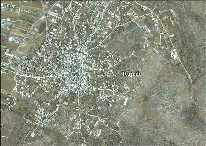
Rujeib
Rujeib | |
|---|---|
| Arabic transcription(s) | |
| • Arabic | روجيب |
| • Latin | Rujib (unofficial) |
| File:Har Gerizim 044.JPG | |
| Lua error in Module:Location_map at line 411: Malformed coordinates value. | |
| Coordinates: Lua error in Module:Coordinates at line 489: attempt to index field 'wikibase' (a nil value). | |
| Palestine grid | 177/177 |
| State | State of Palestine |
| Governorate | Nablus |
| Government | |
| • Type | Village council |
| Population (2017)[1] | |
• Total | 5,964 |
| Name meaning | either from personal name, or for a prop for a tree,[2] |

Rujeib (Arabic: روجيب) is a Palestinian town in the Nablus Governorate of the State of Palestine, in the northern West Bank, located 3 kilometers southeast of Nablus. According to the Palestinian Central Bureau of Statistics (PCBS), the town had a population of 5,964 inhabitants in 2017.[1]
Location
[edit | edit source]Rujeib is located 4.3 km south east of Nablus. It is bordered by Beit Furik to the east, ‘Awarta to the south, and Nablus to the north and west.[3]
History
[edit | edit source]There was a human habitation here during the Chalcolithic era.[4][5]
Sherds from the Late Bronze Age/Iron Age I,[5] Hellenistic,[5][6][7] Roman[5][6] and Byzantine[5][6] eras have been found here.
It has been suggested that Rujeib was the Crusader village Ragabam, which was one of the villages exchanged with Bethany by King Baldwin I and given as a fief to the Church of the Holy Sepulchre.[8][9] Pottery from the Crusader era have also been found here.[5]
Ottoman era
[edit | edit source]In 1517, the village was included in the Ottoman Empire with the rest of Palestine, and in the 1596 tax-records it appeared as Rujib, located in the Nahiya of Jabal Qubal in the Nablus Sanjak. The population was 16 households and 1 bachelors, all Muslim. They paid a fixed tax rate of 33.3% on agricultural products, such as wheat, barley, summer crops, olive trees, goats and beehives, a press for olive oil or grape syrup, in addition to occasional revenues and a fixed tax for people of Nablus area; a total of 3,600 Akçe.[10]
In 1838, Raujib was noted in the El-Beitawy district, east of Nablus, together with Beita, Haudela and Awarta.[11] In 1850/51 de Saulcy noted Roujib on a lower hill than Beit Dejan.[12]
In 1870, Victor Guérin noted that Rujeib was a "village of three hundred inhabitants more, on a hill whose flanks were formerly, in several places, exploited as a quarry. Cactus hedges serve as enclosures for some gardens."[13]
In 1882, the Palestine Exploration Fund's Survey of Western Palestinedescribed Rujib as "A village of moderate size to the east of the plain so named, with a few olives round it."[14]
British Mandate era
[edit | edit source]In the 1922 census of Palestine conducted by the British Mandate authorities, Rujib had a population of 250 Muslims,[15] increasing in the 1931 census to 277 Muslims, in 58 houses.[16]
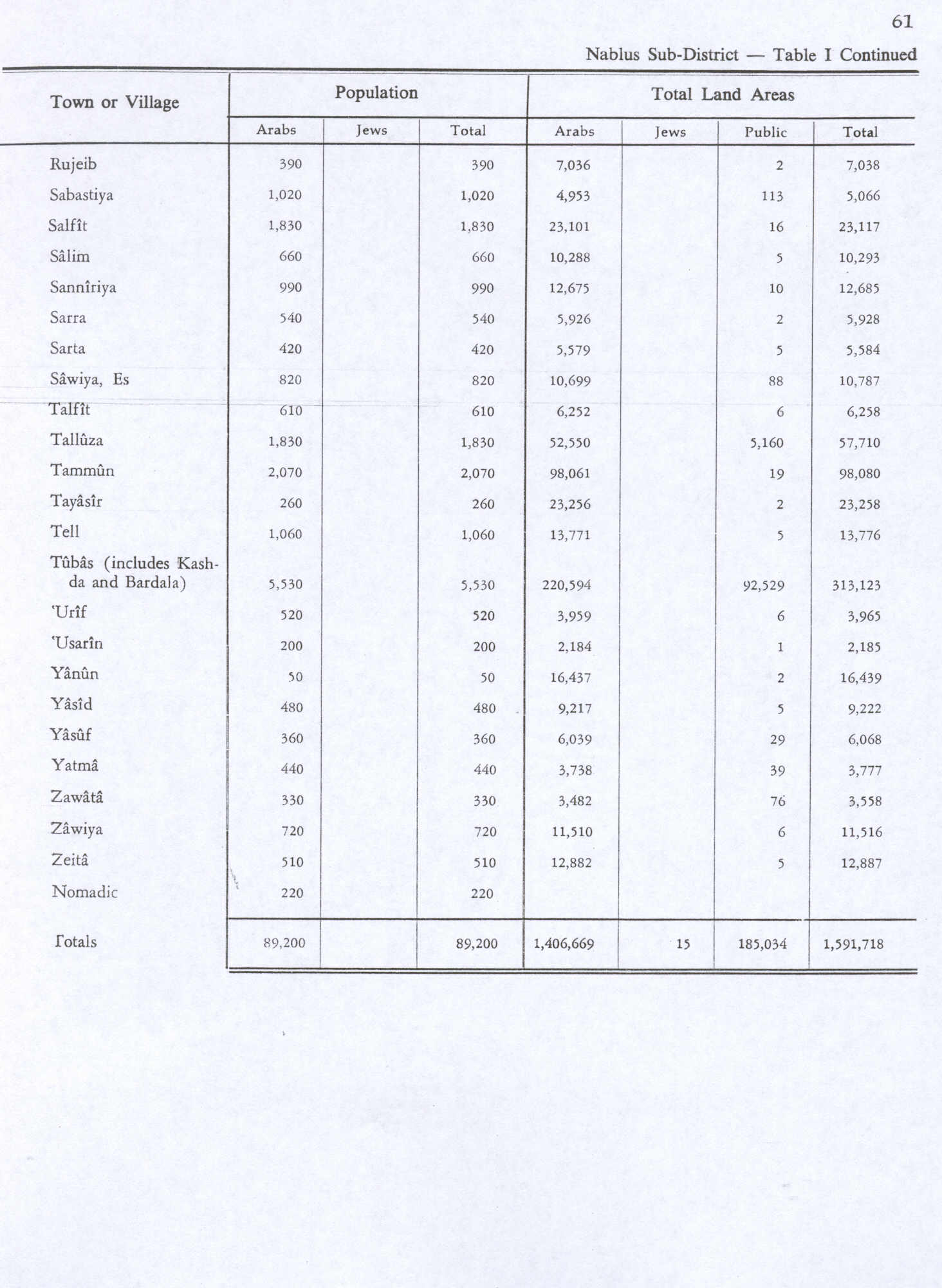
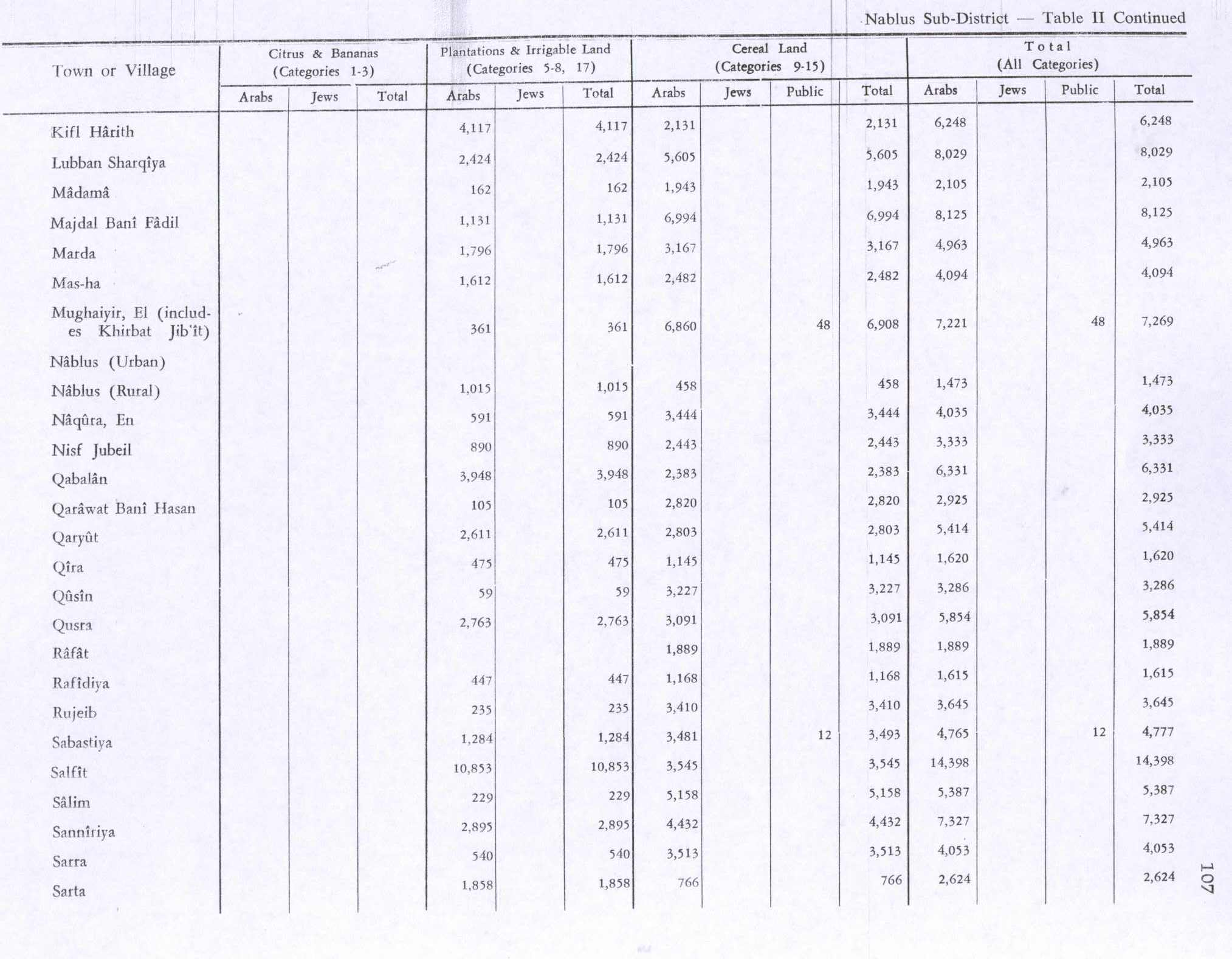
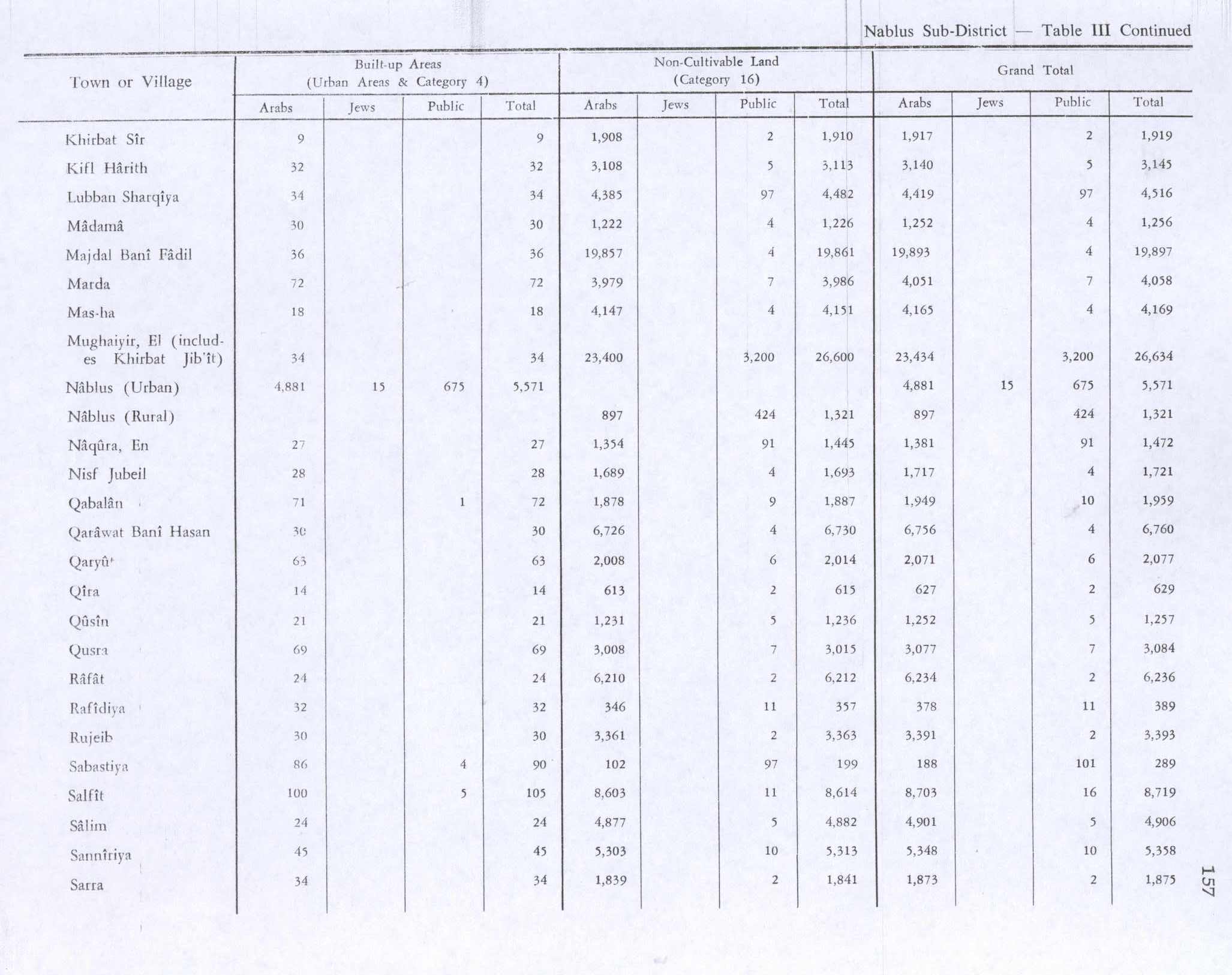
In the 1945 statistics, Rujeib had a population of 390 Muslims[17] while the total land area was 7,038 dunams, according to an official land and population survey.[18] Of this, 235 dunams were used for plantations and irrigable land, 3,410 for cereals,[19] while 30 dunams were classified as built-up (urban) areas.[20]
Jordanian era
[edit | edit source]In the wake of the 1948 Arab–Israeli War, and after the 1949 Armistice Agreements, Rujeib came under Jordanian rule.
In 1961, the population of Rujeib was 628 persons.[21]
Post 1967
[edit | edit source]Since the Six-Day War in 1967, Rujeib has been under Israeli occupation. The population in the 1967 census conducted by Israel was 831, of whom 30 originated from the Israeli territory.[22]
After the 1995 accord 28% of Rujeib’s lands were classified as Area B, the remaining 72% as Area C. Israel has confiscated 169 dunams of land from Rujeib for construction of the Israeli settlement of Itamar.[23]
Demography
[edit | edit source]Origins
[edit | edit source]Residents of Rujeib have their origins and family connections in the village of Beita.[24]
References
[edit | edit source]- ^ a b Lua error in Module:Citation/CS1/Configuration at line 2172: attempt to index field '?' (a nil value).
- ^ Palmer, 1881, p. 189
- ^ Rujeib village profile, ARIJ, p. 4
- ^ Jaroš and Deckert, 1977, p. 28
- ^ a b c d e f Bull and Campbell, 1968, p. 31
- ^ a b c Finkelstein et al, 1997, p. 709
- ^ Jaroš and Deckert, 1977, p. 44
- ^ Conder and Kitchener, 1883, SWP III, p. 11
- ^ Conder, 1890, p. 33 NB: Conder mistakenly places Rujeib on SWP map 14
- ^ Hütteroth and Abdulfattah, 1977, p. 135
- ^ Robinson and Smith, 1841, vol 3, pp. 94, 103, 2nd Appendix, p. 128
- ^ Saulcy, 1854, vol 1, p. 99
- ^ Guérin, 1874, pp. 462 -463
- ^ Conder and Kitchener, 1882, SWP II, p. 168
- ^ Barron, 1923, Table IX, p. 24
- ^ Mills, 1932, p. 64
- ^ Government of Palestine, Department of Statistics, 1945, p. 19
- ^ Government of Palestine, Department of Statistics. Village Statistics, April, 1945. Quoted in Hadawi, 1970, p. 61
- ^ Government of Palestine, Department of Statistics. Village Statistics, April, 1945. Quoted in Hadawi, 1970, p. 107
- ^ Government of Palestine, Department of Statistics. Village Statistics, April, 1945. Quoted in Hadawi, 1970, p. 157
- ^ Government of Jordan, Department of Statistics, 1964, p. 26
- ^ Lua error in Module:Citation/CS1/Configuration at line 2172: attempt to index field '?' (a nil value).
- ^ Rujeib village profile, ARIJ, p. 14
- ^ Grossman, D. (1986). "Oscillations in the Rural Settlement of Samaria and Judaea in the Ottoman Period". in Shomron studies. Dar, S., Safrai, S., (eds). Tel Aviv: Hakibbutz Hameuchad Publishing House. p. 356

Bibliography
[edit | edit source]- Lua error in Module:Citation/CS1/Configuration at line 2172: attempt to index field '?' (a nil value).
- Lua error in Module:Citation/CS1/Configuration at line 2172: attempt to index field '?' (a nil value).
- Lua error in Module:Citation/CS1/Configuration at line 2172: attempt to index field '?' (a nil value).
- Lua error in Module:Citation/CS1/Configuration at line 2172: attempt to index field '?' (a nil value).
- Lua error in Module:Citation/CS1/Configuration at line 2172: attempt to index field '?' (a nil value).
- Lua error in Module:Citation/CS1/Configuration at line 2172: attempt to index field '?' (a nil value).
- Lua error in Module:Citation/CS1/Configuration at line 2172: attempt to index field '?' (a nil value).
- Lua error in Module:Citation/CS1/Configuration at line 2172: attempt to index field '?' (a nil value).
- Lua error in Module:Citation/CS1/Configuration at line 2172: attempt to index field '?' (a nil value).
- Lua error in Module:Citation/CS1/Configuration at line 2172: attempt to index field '?' (a nil value).
- Lua error in Module:Citation/CS1/Configuration at line 2172: attempt to index field '?' (a nil value).
- Lua error in Module:Citation/CS1/Configuration at line 2172: attempt to index field '?' (a nil value).
- Lua error in Module:Citation/CS1/Configuration at line 2172: attempt to index field '?' (a nil value).
- Lua error in Module:Citation/CS1/Configuration at line 2172: attempt to index field '?' (a nil value).
- Lua error in Module:Citation/CS1/Configuration at line 2172: attempt to index field '?' (a nil value).
- Lua error in Module:Citation/CS1/Configuration at line 2172: attempt to index field '?' (a nil value).
External links
[edit | edit source]- Welcome to Rujeib
- Rujeib Welcome to Palestine
- Survey of Western Palestine, Map 11: IAA, Wikimedia commons
- Rujeib village profile, Applied Research Institute–Jerusalem (ARIJ)
- Rujeib (aerial photo), ARIJ
- Development Priorities and Needs in Rujeib, ARIJ