ar-Rihiya
ar-Rihiya | |
|---|---|
| Arabic transcription(s) | |
| • Arabic | ريحيا |
| Lua error in Module:Location_map at line 411: Malformed coordinates value. | |
| Coordinates: Lua error in Module:Coordinates at line 489: attempt to index field 'wikibase' (a nil value). | |
| Palestine grid | 157/097 |
| State | State of Palestine |
| Governorate | Hebron |
| Government | |
| • Type | Village council |
| Population (2017)[1] | |
• Total | 5,754 |
| Name meaning | Possibly "The coiled-up snake"[2] |
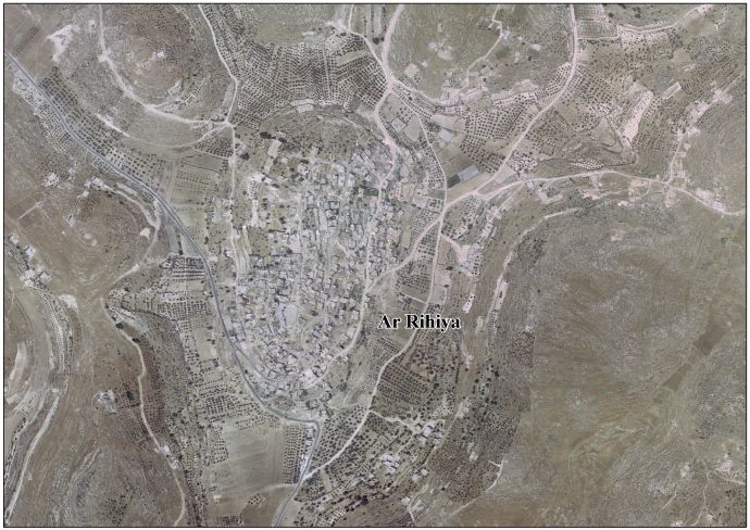
Ar-Rihiya (Arabic: ريحيا) is a Palestinian town located six kilometers southwest of Hebron. The town is in the Hebron Governorate southern West Bank. According to the Palestinian Central Bureau of Statistics, the town had a population of over 5,754 in 2017.[1]
History
Ceramics from the Byzantine era have been found here.[3]
Ottoman period
Oral tradition suggests that Ar-Rihiya was founded after the 16th century.[4] The village likely originated in the 19th century, founded by Kurds from Tubas who grazed their herds in the vicinity. Before the establishment of the village, they dwelled in nearby caves.[5]
French explorer Victor Guérin visited the place in 1863, which he called Khirbet el-Harayeh. Local fellahins inhabited ancient underground storage areas.[6]
In 1883, the PEF's Survey of Western Palestine described the place as being a "large ruin with caves and cisterns, appears to be an ancient site".[7]
British Mandate
In the 1922 census of Palestine conducted by the British Mandate authorities, 'Al Rihiyeh had a population 231 inhabitants, all Muslims.[8] This had increased slightly at the time of the 1931 census to 243 Muslims, in 38 inhabited houses.[9]
In the 1945 statistics the population of Ar-Rihiya was 330 Muslims,[10] who owned 2,659 dunams of land according to an official land and population survey.[11] 136 dunams were plantations and irrigable land, 1,093 for cereals,[12] while 25 dunams were built-up (urban) land.[13]
Jordanian rule
In the wake of the 1948 Arab–Israeli War, and after the 1949 Armistice Agreements, Ar-Rihiya came under Jordanian rule. It was annexed by Jordan in 1950.
In 1961, the population of Rihiya was 555.[14]
Post-1967
Since the Six-Day War in 1967, Ar-Rihiya has been under Israeli occupation.
Footnotes
- ^ a b Lua error in Module:Citation/CS1/Configuration at line 2172: attempt to index field '?' (a nil value).
- ^ According to Palmer, 1881, p. 405, the name might also come from "A millstone", or "A plot of ground, about a mile square, above the water level".
- ^ Dauphin, 1998, p. 963
- ^ Grossman, D. "The expansion of the settlement frontier of Hebron's western and southern fringes". Geography Research Forum, 5, 1982, p. 62.
- ^ Grossman, D. (1986). "Oscillations in the Rural Settlement of Samaria and Judaea in the Ottoman Period". in Shomron studies. Dar, S., Safrai, S., (eds). Tel Aviv: Hakibbutz Hameuchad Publishing House. p. 369
- ^ Guérin, 1869, pp. 211 -212
- ^ Conder and Kitchener, 1883, SWP III, p. 377
- ^ Barron, 1923, Table V, Sub-district of Hebron, p. 10
- ^ Mills, 1932, p. 33
- ^ Government of Palestine, Department of Statistics, 1945, p. 23
- ^ Government of Palestine, Department of Statistics. Village Statistics, April, 1945. Quoted in Hadawi, 1970, p. 50 Archived 2011-06-04 at the Wayback Machine
- ^ Government of Palestine, Department of Statistics. Village Statistics, April, 1945. Quoted in Hadawi, 1970, p. 94
- ^ Government of Palestine, Department of Statistics. Village Statistics, April, 1945. Quoted in Hadawi, 1970, p. 144
- ^ Government of Jordan, Department of Statistics, 1964, p. 22
Bibliography
- Lua error in Module:Citation/CS1/Configuration at line 2172: attempt to index field '?' (a nil value).
- Lua error in Module:Citation/CS1/Configuration at line 2172: attempt to index field '?' (a nil value).
- Lua error in Module:Citation/CS1/Configuration at line 2172: attempt to index field '?' (a nil value).
- Lua error in Module:Citation/CS1/Configuration at line 2172: attempt to index field '?' (a nil value).
- Lua error in Module:Citation/CS1/Configuration at line 2172: attempt to index field '?' (a nil value).
- Lua error in Module:Citation/CS1/Configuration at line 2172: attempt to index field '?' (a nil value).
- Lua error in Module:Citation/CS1/Configuration at line 2172: attempt to index field '?' (a nil value).
- Lua error in Module:Citation/CS1/Configuration at line 2172: attempt to index field '?' (a nil value).
- Lua error in Module:Citation/CS1/Configuration at line 2172: attempt to index field '?' (a nil value).
External links
- Welcome To al-Rihiya
- Survey of Western Palestine, Map 21: IAA, Wikimedia commons
- Ar Rihiya Village (Fact Sheet), Applied Research Institute–Jerusalem, ARIJ
- Ar Rihiya Village Profile, ARIJ
- Ar Rihiya VillageArea Photo, ARIJ
- The priorities and needs for development in Ar Rihiya village based on the community and local authorities’ assessment, ARIJ
