Strong Township, Chase County, Kansas
Jump to navigation
Jump to search
Strong Township | |
|---|---|
 Location within Chase County | |
| Lua error in Module:Location_map at line 411: Malformed coordinates value. | |
| Coordinates: Lua error in Module:Coordinates at line 489: attempt to index field 'wikibase' (a nil value). | |
| Country | United States |
| State | Kansas |
| County | Chase |
| Area | |
• Total | 66.71 sq mi (172.78 km2) |
| • Land | 66.55 sq mi (172.36 km2) |
| • Water | 0.16 sq mi (0.42 km2) 0.24% |
| Elevation | 1,385 ft (422 m) |
| Population (2020) | |
• Total | 507 |
| • Density | 7.62/sq mi (2.94/km2) |
| GNIS feature ID | 0477166 |
Strong Township is a township in Chase County, Kansas, United States. As of the 2020 census, its population was 507.[1]
Geography
[edit | edit source]Strong Township covers an area of 66.71 square miles (172.8 km2). The streams of Fox Creek, Indian Creek, Palmer Creek and Prather Creek run through this township.
Communities
[edit | edit source]The township contains the following settlements:
- City of Strong City.
Cemeteries
[edit | edit source]The township contains the following cemeteries:
- Saint Anthony.
- Simmons.
- Strong Township.
Further reading
[edit | edit source]References
[edit | edit source]- ^ Lua error in Module:Citation/CS1/Configuration at line 2172: attempt to index field '?' (a nil value).
External links
[edit | edit source]Municipalities and communities of Chase County, Kansas, United States | ||
|---|---|---|
| Cities | 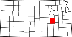 | |
| Unincorporated communities | ||
| Ghost towns | ||
| Townships | ||
| Footnotes | ‡This community also has portions in an adjacent county or counties. | |
Lua error in Module:Authority_control at line 153: attempt to index field 'wikibase' (a nil value).