Matfield Township, Chase County, Kansas
Jump to navigation
Jump to search
Matfield Township | |
|---|---|
 Location within Chase County | |
| Lua error in Module:Location_map at line 411: Malformed coordinates value. | |
| Coordinates: Lua error in Module:Coordinates at line 489: attempt to index field 'wikibase' (a nil value). | |
| Country | United States |
| State | Kansas |
| County | Chase |
| Area | |
• Total | 122.43 sq mi (317.08 km2) |
| • Land | 122.07 sq mi (316.16 km2) |
| • Water | 0.36 sq mi (0.92 km2) 0.29% |
| Elevation | 1,424 ft (434 m) |
| Population (2000) | |
• Total | 155 |
| • Density | 1.3/sq mi (0.5/km2) |
| GNIS feature ID | 0477823 |
Matfield Township is a township in Chase County, Kansas, United States. As of the 2000 census, its population was 155.
Geography
[edit | edit source]Matfield Township covers an area of 122.42 square miles (317.1 km2). The streams of Bull Creek, Camp Creek, Corn Creek, Crocker Creek, Jack Creek, Little Cedar Creek, Mercer Creek, Shaw Creek, Steak Bake Creek and Thurman Creek run through this township.
Communities
[edit | edit source]The township contains the following settlements:
- City of Matfield Green.
- Ghost town of Thurman.
Cemeteries
[edit | edit source]The township contains the following cemeteries:
- High Prairie.
- Matfield Green.
Further reading
[edit | edit source]References
[edit | edit source]External links
[edit | edit source]Municipalities and communities of Chase County, Kansas, United States | ||
|---|---|---|
| Cities | 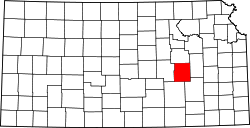 | |
| Unincorporated communities | ||
| Ghost towns | ||
| Townships | ||
| Footnotes | ‡This community also has portions in an adjacent county or counties. | |
Lua error in Module:Authority_control at line 153: attempt to index field 'wikibase' (a nil value).