Batorampon Point
Batorampon Point
Batalampon Point | |
|---|---|
| Lua error in Module:Infobox_mapframe at line 197: attempt to index field 'wikibase' (a nil value). | |
| Coordinates: Lua error in Module:Coordinates at line 489: attempt to index field 'wikibase' (a nil value). | |
| Location | Labuan, IX, File:Flag of the Philippines.svg Philippines |

| Batorampon Point | |
|---|---|
| Lua error in Module:Infobox_mapframe at line 197: attempt to index field 'wikibase' (a nil value). | |
| Highest point | |
| Elevation | 1,335 m (4,380 ft) |
| Coordinates | Lua error: callParserFunction: function "#coordinates" was not found. |
| Geography | |
| Location | Zamboanga City, Philippines |
| Parent range | Zamboanga Cordillera, Mindanao Island |
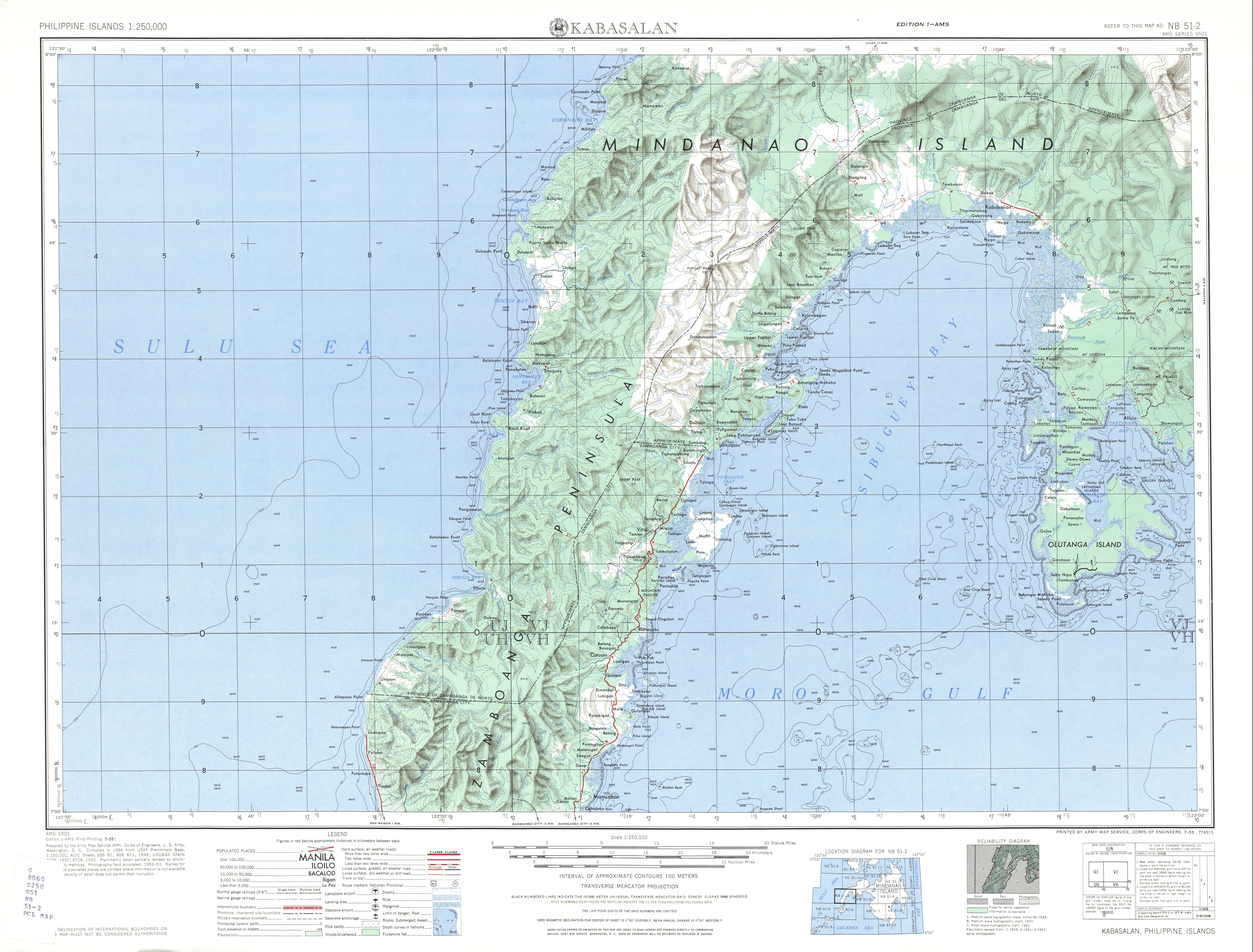
Batorampon Point is the westernmost point of the island of Mindanao (Lua error: callParserFunction: function "#coordinates" was not found.) in the Philippines and has been named so since the mid-19th century.[1][2][3] The rocky cliff, located within the limits of the City of Zamboanga, was previously known as Batalampon Point, becoming Batorampon Point in the 1940s.[4][5] The point is located just north of Labuan, about 35 kilometres (22 mi) from downtown Zamboanga City.
Batorampon Point is also the alleged name[6] of the highest elevation in Zamboanga City located in Lua error: callParserFunction: function "#coordinates" was not found.. The peak was not named in the 1940s topography map of the region by the U.S. Army's topographic engineering agency, the Army Map Service.[4] When it was named Batorampon Point is not known.
References
[edit | edit source]- ^ Bowring, Sir John (1859). "A Visit to the Philippines", pg. 417. Smith, Elder & Co., London.
- ^ U.S. Coast and Geodetic Survey (1906) "Philippine Island Sailing Directions", pg. 23. Manila Bureau of Printing.
- ^ "Batorampon Point". Traveling luck. Retrieved on 2011-10-01.
- ^ a b U.S. Army Map Service, Corps of Engineers "Kabasalan - Zamboanga City Map". University of Texas in Austin Library. Retrieved on 2011-10-01.
- ^ Great Britain Hydrographic Department (1902). "Eastern Archipelago, Part 1: Eastern part". pg. 324.
- ^ "Bodies of water surrounding Zamboanga City" Zamboanga.com.