Wainlode Cliff
Jump to navigation
Jump to search
| Site of Special Scientific Interest | |
 | |
| Lua error in Module:Location_map at line 411: Malformed coordinates value. | |
| Location | Gloucestershire |
|---|---|
| Grid reference | SO845257 |
| Coordinates | Lua error in Module:Coordinates at line 489: attempt to index field 'wikibase' (a nil value). |
| Interest | Geological |
| Area | 1.3 hectare |
| Notification | 1954 |
| Natural England website | |
Wainlode Cliff (grid reference SO845257) is a privately owned 1.3 hectare geological Site of Special Scientific Interest in Gloucestershire, notified in 1954.[1][2] It overlooks Hasfield Ham.
Geology
[edit | edit source]This an historic locality which was first described in 1842 and shows a seven-metre section of Rhaetian age. The site mains the regional two-fold division of Westbury and Cotham Beds. The Insect Limestone, which is a productive source of insects, defines the base of the Lias.[1]
Gallery
[edit | edit source]-
 View from above Wainlode Cliff overlooking Hasfield Ham
 -
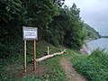 Fishing sign for Wainlode Cliff and access to the riverbank.


Sources
[edit | edit source]- Natural England SSSI information on citation, map and unit details
- Natural England SSSI information on the Wainlode Cliff unit
References
[edit | edit source]- ^ a b Natural England SSSI information on citation, map and unit details
- ^ Lua error in Module:Citation/CS1/Configuration at line 2172: attempt to index field '?' (a nil value).
External links
[edit | edit source]- English Nature (SSSI information)
This article about a Site of Special Scientific Interest in England is a stub. You can help Wikipedia by expanding it. |
This Gloucestershire location article is a stub. You can help Wikipedia by expanding it. |