Upper Lybster
Jump to navigation
Jump to search
| Upper Lybster | |
|---|---|
| Lua error in Module:Location_map at line 411: Malformed coordinates value. | |
| OS grid reference | ND249373 |
| Council area | |
| Country | Scotland |
| Sovereign state | United Kingdom |
| Post town | Lybster |
| Postcode district | KW3 6 |
| Police | Scotland |
| Fire | Scottish |
| Ambulance | Scottish |
Upper Lybster is a scattered and crofting village, situated 2 miles north of Lybster, in eastern Caithness, Scottish Highlands[1] and is in the Scottish council area of Highland.
Gallery
[edit | edit source]-
 Lower Smerlie. Cuigs croft lower Smerlie. Typical croft land that once had many small crofts like this one.
 -
 Lybster Harbour
 -
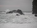 High seas at Lybster Harbour
 -
The Old Mill, Clashnaharribeg, Upper Lybster. Derelict Croft House and outbuildings
-
Gray's Place, Lybster The wide main street of this C19th 'planned village'. No mean feat to stretch bunting diagonally across it!
-
Lybster Free Church
-
Lybster old Free Church.
-
Ruins of croft house, Upper Smerlie. This old house was occupied up until the 1980s and was not long unoccupied when struck by lightning. The land around has many similar such old croft houses scattered around.
-
Early Christian Incised Cross in shelter by church
-
Long Cairn from Round Cairn


References
[edit | edit source]- ^ Lua error in Module:Citation/CS1/Configuration at line 2172: attempt to index field '?' (a nil value).