The Baths
| The Baths National Park | |
|---|---|
| File:TheBaths VirginGorda BVI.jpg One of many baths found among scattered granite boulders | |
| Lua error in Module:Location_map at line 411: Malformed coordinates value. | |
| Type | Natural Area |
| Location | Virgin Gorda, British Virgin Islands |
| Coordinates | Lua error in Module:Coordinates at line 489: attempt to index field 'wikibase' (a nil value). |
The Baths is a beach area on the island of Virgin Gorda among the British Virgin Islands in the Caribbean.
Geography
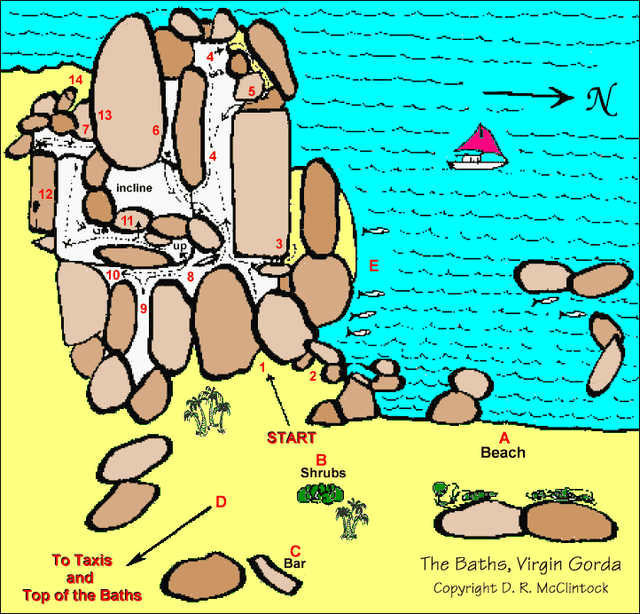
[edit | edit source]The Baths is situated about 1.2 miles (1.9 km) south off Spanish Town at the southern tip of the island between Spring Bay and Devil's Bay. The Baths is an area of unique geologic formations (batholiths) and one of the BVI's major tourist destinations.
Area
[edit | edit source]Although volcanism accounts for much of the Virgin Islands, The Baths was formed by granite that eroded into piles of boulders on the beach.[1] Granite forms from the slow cooling of magma at depth nowhere close to surface volcanoes. The granite only appears at the surface after geologic ages have eroded away all the overburden covering it. Once exposed, erosion continued to isolate the granite into large boulders and round their surfaces. The boulders form natural tidal pools, tunnels, arches, and scenic grottoes that are open to the sea.[2] The largest boulders are about 40 feet (12 m) long.
Since 1990, the area has been a BVI National Park [3] as are the adjacent bays,[4] and the area is a major tourist attraction, with swimming and snorkeling being the main attractions.
Gallery
[edit | edit source]-
The Baths
-
Boulders at The Baths
-
Rock formation at The Baths
-
Bay area at The Baths
-
Underwater Cave at The Baths
Notes
[edit | edit source]- ^ Excerpt from The Baths by Julian Putley
- ^ Lua error in Module:Citation/CS1/Configuration at line 2172: attempt to index field '?' (a nil value).
- ^ Welcome to the BVI National Parks Trust – Parks – Virgin Gorda 2
- ^ National Parks | British Virgin Islands | Caribbean Destination | BVI
External links
[edit | edit source]Error creating thumbnail: File missing Media related to Lua error in Module:Commons_link at line 62: attempt to index field 'wikibase' (a nil value). at Wikimedia Commons