Tauthali
Jump to navigation
Jump to search
This article needs additional citations for verification. (March 2020) |
Tauthali
तौथली | |
|---|---|
Village | |
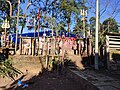
 Shikharchuli view | |
| Lua error in Module:Location_map at line 411: Malformed coordinates value. | |
| Coordinates: Lua error in Module:Coordinates at line 489: attempt to index field 'wikibase' (a nil value). | |
| Country | File:Flag of Nepal.svg Nepal |
| Province | Bagmati Province |
| District | Sindhupalchok District |
| Population (2011) | |
• Total | 2,762 |
| Time zone | UTC+5:45 (Nepal Time) |
Tauthali (Nepali: तौथली) is a village in Sindhupalchok District in Bagmati Province, central Nepal. Tauthali is 110 km away from Kathmandu.
As of 2011[update] census, the population was 2,762 (1,507 females and 1,255 males) in 776 households.[1]
In the devastating earthquake of 2015, almost every house was destroyed including religious sites such as the temple of Tripura Sundari Mai. Within three years of the disaster, almost all houses had been rebuilt, completely transforming the village compared to before the earthquake.
Notable attractions
[edit | edit source]- The Tripura Sundari Mai temple
- Bhimeshwor temple
- Dahi Jatra, a jatra (street festival) celebrated by people splashing yoghurt on each other, in reverence to the Hindu goddess, Tripura Sundari
Gallery
[edit | edit source]-
 Tauthali Village
 -
 Newar dance
 -
 Sunset view from Tauthali (Jabshiley)
 -
 Shree Tripura Sundari Mai before the 2015 earthquake
 -
 Shree Tripura Sundari Mai (under reconstruction in 2019-20)


References
[edit | edit source]- ^ Lua error in Module:Citation/CS1/Configuration at line 2172: attempt to index field '?' (a nil value).