Slootdorp
Jump to navigation
Jump to search
Slootdorp | |
|---|---|
Village | |
| Jewish agricultural training center Jewish agricultural training center | |
| Lua error in Module:Location_map at line 411: Malformed coordinates value. | |
| Coordinates: Lua error in Module:Coordinates at line 489: attempt to index field 'wikibase' (a nil value). | |
| Country | Netherlands |
| Province | North Holland |
| Municipality | Hollands Kroon |
| Area | |
• Village | 65.60 km2 (25.33 sq mi) |
| Elevation | −3.2 m (−10 ft) |
| Population (2025)[1] | |
• Village | 2,290 |
| • Density | 34.9/km2 (90.4/sq mi) |
| • Urban | 1,385 |
| • Rural | 905 |
| Time zone | UTC+1 (CET) |
| • Summer (DST) | UTC+2 (CEST) |
| Postal code | 1774[1] |
| Dialing code | 0227 |
Slootdorp is a village in the Dutch province of North Holland. It is a part of the municipality of Hollands Kroon, and lies about 19 km southeast of Den Helder.
The village is a local hub for farming with a small number of shops. The population has been steadily dwindling. It is serviced by a number of intersecting districts canals. A number of local businesses still use these canals as the main method of transport of goods.
Gallery
[edit | edit source]-
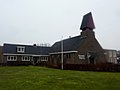 Dutch Reformed church
 -
Farm in Slootdorp
-
Farm in Slootdorp

References
[edit | edit source]
Wikimedia Commons has media related to [[commons:Lua error in Module:WikidataIB at line 506: attempt to index field 'wikibase' (a nil value).|Lua error in Module:WikidataIB at line 506: attempt to index field 'wikibase' (a nil value).]].
Lua error in Module:Authority_control at line 153: attempt to index field 'wikibase' (a nil value).