Slaughter Mountain
Jump to navigation
Jump to search
| Slaughter Mountain | |
|---|---|
| File:Slaughter Mountain viewed from Lake Winfield Scott 2.JPG Slaughter Mountain, viewed from Lake Winfield Scott | |
| Highest point | |
| Elevation | 4,338 ft (1,322 m)[1] |
| Prominence | 458 ft (139.6 m)[1] |
| Coordinates | Lua error in Module:Coordinates at line 489: attempt to index field 'wikibase' (a nil value).[2] |
| Geography | |
| Lua error in Module:Infobox_mapframe at line 197: attempt to index field 'wikibase' (a nil value). | |
| Location | Union County, Georgia, U.S. |
| Parent range | Blue Ridge Mountains |
| Topo map | USGS Neels Gap |
| Climbing | |
| Easiest route | Coosa Backcountry Trail, Duncan Ridge Trail |
Slaughter Mountain, with an elevation of 4,338 ft (1,322 m), is the ninth-highest peak in the U.S. state of Georgia.[3] It is located in Union County, Georgia and is the second-highest mountain in Union County. Its nearest higher neighbor is Blood Mountain, the highest peak in Union County and sixth-highest in Georgia.
Slaughter Mountain was named in commemoration of a bloody battle between the Cherokee and Creek Indians.[4]
Gallery
[edit | edit source]-
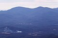 Blood Mountain (L) and Slaughter Mountain (R), as seen from Brasstown Bald
 -
Slaughter Mountain viewed from Vogel State Park
-
Slaughter Mountain viewed from the Appalachian Trail


.jpg)
See also
[edit | edit source]References
[edit | edit source]- ^ a b Lua error in Module:Citation/CS1/Configuration at line 2172: attempt to index field '?' (a nil value).
- ^ Lua error in Module:Citation/CS1/Configuration at line 2172: attempt to index field '?' (a nil value).
- ^ Lua error in Module:Citation/CS1/Configuration at line 2172: attempt to index field '?' (a nil value).
- ^ Lua error in Module:Citation/CS1/Configuration at line 2172: attempt to index field '?' (a nil value).
External links
[edit | edit source]
Wikimedia Commons has media related to Slaughter Mountain.