Shadowood, Oregon
Shadowood, Oregon | |
|---|---|
 Street in the community | |
| Lua error in Module:Location_map at line 411: Malformed coordinates value. | |
| Coordinates: Lua error in Module:Coordinates at line 489: attempt to index field 'wikibase' (a nil value). | |
| Country | United States |
| State | Oregon |
| County | Clackamas |
| Elevation | 190 ft (58 m) |
| Time zone | UTC-8 (Pacific (PST)) |
| • Summer (DST) | UTC-7 (PDT) |
| ZIP code | 97068 |
| GNIS feature ID | 1136738[1] |
Shadowood is an unincorporated community in Clackamas County, Oregon, United States, about four miles south of Lake Oswego on the Tualatin River east of Shipley Bridge. Shadowood has a West Linn ZIP code.
The Shadowood area is a rural neighborhood comprising approximately 64 residences on both sides of a ravine formed by an unnamed creek and containing wetlands.[2] The subdivision is served by a water system originally constructed in 1922 that started providing service in 1924.[2]
The subdivision is named Shadow Wood Park and was originally a 1920s development of recreational retreats.[3][4] The original residences were American Craftsman/Rustic-style log houses.[4]
References
[edit | edit source]- ^ a b U.S. Geological Survey Geographic Names Information System: Shadowood, Oregon
- ^ a b Lua error in Module:Citation/CS1/Configuration at line 2172: attempt to index field '?' (a nil value).
- ^ Lua error in Module:Citation/CS1/Configuration at line 2172: attempt to index field '?' (a nil value).
- ^ a b Lua error in Module:Citation/CS1/Configuration at line 2172: attempt to index field '?' (a nil value).
Municipalities and communities of Clackamas County, Oregon, United States | ||
|---|---|---|
| Cities | 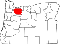 | |
| Hamlets | ||
| CDPs | ||
| Other communities |
| |
| Indian reservation | ||
| Footnotes | ‡This populated place also has portions in an adjacent county or counties | |
Lua error in Module:Authority_control at line 153: attempt to index field 'wikibase' (a nil value).
 | This Clackamas County, Oregon state location article is a stub. You can help Wikipedia by expanding it. |