Seikphyu
Jump to navigation
Jump to search
Seikphyu | |
|---|---|
Town | |
| Lua error in Module:Location_map at line 411: Malformed coordinates value. | |
| Coordinates: Lua error in Module:Coordinates at line 489: attempt to index field 'wikibase' (a nil value). | |
| Country | File:Flag of Myanmar.svg Myanmar |
| Region | File:Flag of Magway Region.svg Magway Region |
| District | Pakokku District |
| Township | Seikphyu Township |
| Elevation | 62 m (204 ft) |
| Time zone | UTC+6.30 (MST) |
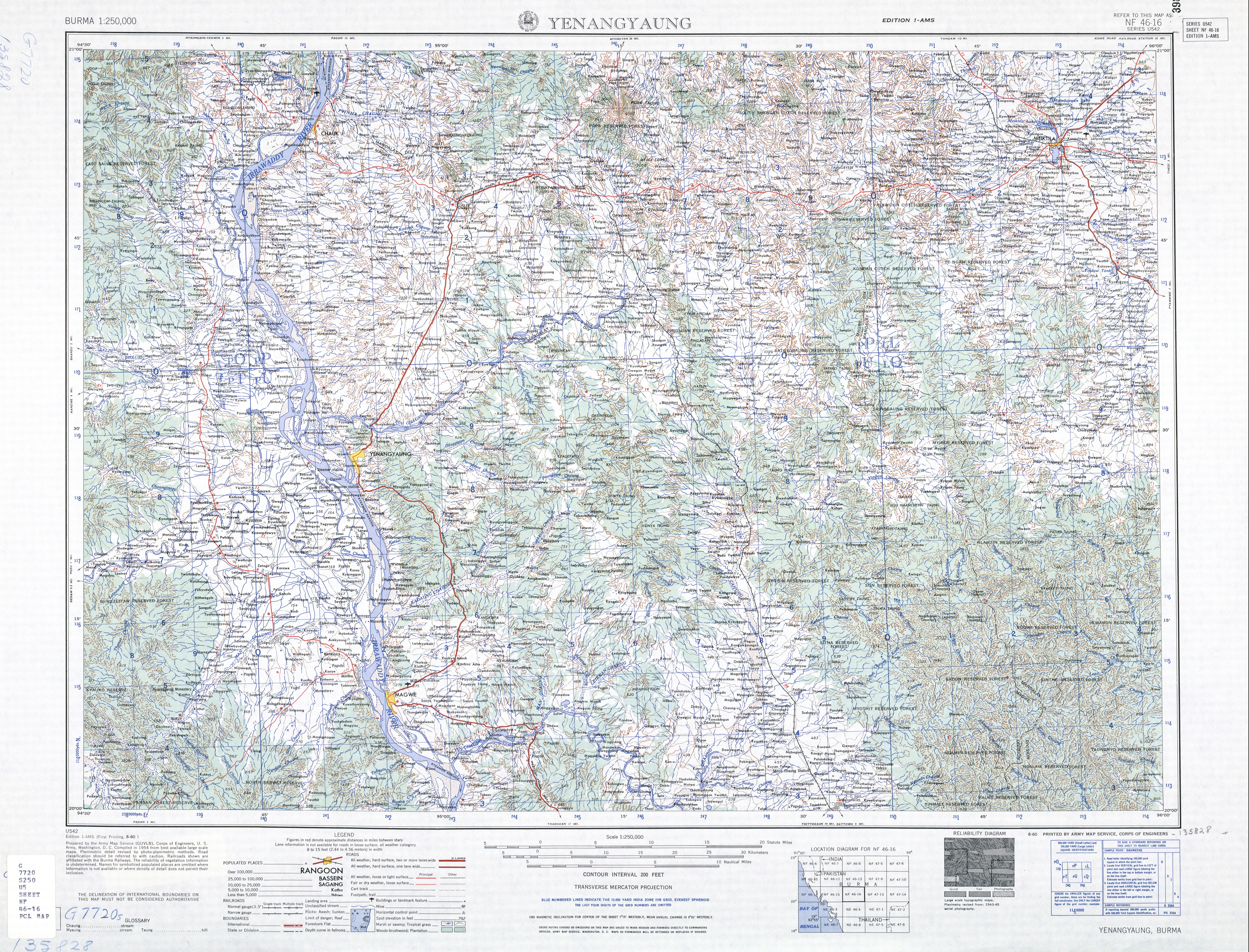
Seikphyu[1] (Burmese: ဆိပ်ဖြူ) is the principal town and administrative seat for Seikphyu Township in Pakokku District in the Magway Division of Myanmar, on the right (western) bank of the Irrawaddy immediately below its confluence with the Yaw River. It is located across the Irrawaddy river from Chauk and is connected by Anawrahta Bridge.[2] It is situated 34 kilometers south-south-west of ancient Bagan City and 44 kilometers from Nyaung U Airport.
Notes
[edit | edit source]- ^ Seikphyu at GEOnet Names Server, United States National Geospatial-Intelligence Agency
- ^ "Burma 1:250,000 topographic map, Series U542, NF 46-16 Yenangyaung" U.S. Army Map Service, August 1960
External links
[edit | edit source]- Lua error in Module:Citation/CS1/Configuration at line 2172: attempt to index field '?' (a nil value).
- "Seikpyu Map — Satellite Images of Seikpyu" Maplandia World Gazetteer