Scheyern
Jump to navigation
Jump to search
Scheyern | |
|---|---|
| Scheyern Abbey | |
|
Coat of arms of Scheyern Coat of arms | |
Location of Scheyern
within Pfaffenhofen an der Ilm district 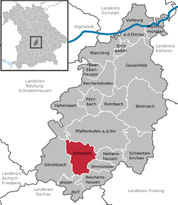 | |
| Lua error in Module:Infobox_mapframe at line 197: attempt to index field 'wikibase' (a nil value). | |
| Lua error in Module:Location_map at line 411: Malformed coordinates value. | |
| Coordinates: Lua error in Module:Coordinates at line 489: attempt to index field 'wikibase' (a nil value). | |
| Country | Germany |
| State | Bavaria |
| Admin. region | Oberbayern |
| District | Pfaffenhofen an der Ilm |
| Government | |
| • Mayor (2020–26) | Manfred Sterz[1] (FW) |
| Area | |
• Total | 38.29 km2 (14.78 sq mi) |
| Elevation | 479 m (1,572 ft) |
| Population (Lua error in Module:Settlement_Wikidata at line 197: attempt to index field 'wikibase' (a nil value).)Lua error in Module:Settlement_Wikidata at line 197: attempt to index field 'wikibase' (a nil value). | |
• Total | Lua error in Module:Settlement_Wikidata at line 197: attempt to index field 'wikibase' (a nil value). |
| Time zone | UTC+01:00 (CET) |
| • Summer (DST) | UTC+02:00 (CEST) |
| Postal codes | 85298 |
| Dialling codes | 08441 |
| Vehicle registration | PAF |
| Website | www.scheyern.de |
Scheyern (German pronunciation: [ˈʃaɪɐn]) is a municipality in the district of Pfaffenhofen in Bavaria in Germany. The Scheyern Abbey is located in Scheyern.
The title the counts of Scheyern originated here (see House of Wittelsbach).
The village of Fernhag lies just outside the town.
References
[edit | edit source]
Lua error in Module:Authority_control at line 153: attempt to index field 'wikibase' (a nil value).