MyWiki:WikiProject Maps/Conventions/Pushpin maps
Jump to navigation
Jump to search
Case 1
Pushpin maps best practices have been requested by JASpencer (talk) on 14th September 2012. Based on current practices and/or interesting new practices, a guideline can be proposed.
Pushpin maps: Current practices
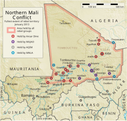
[edit source]I found the 3 cases for wikipedia pushpin maps.
- Case 1: You can draw it completely in SVG, like the Mali map.
- Case 2: ({location maps+}
- Case 3: make an external google maps. Yug (talk) 15:13, 15 September 2012 (UTC)
- Case 4: Some random pushpin maps images from the web), but you can suggest us a convention on the same principle that our other Map Conventions. Yug (talk) 14:56, 15 September 2012 (UTC)

Case 2. Location of some of the several dozen attacks and protests.

See also
[edit source]Map conventions and Map Project | |||
|---|---|---|---|
 | Conventions set |  | |
| Drafts | |||
| Others |
| ||