MyWiki:WikiProject Bristol/Maps
Jump to navigation
Jump to search
Lua error in Module:Coordinates at line 489: attempt to index field 'wikibase' (a nil value).
Blaise Castle, shown within Bristol and the UK
There is a template for adding maps to Bristol articles in a standard format:
{{Location map|Bristol
| lat  = <!-- Required, e.g., 51.5041 -->
| long = <!-- Required, e.g., -2.6324 -->
| label= <!-- Optional - text placed next to the marker on the map -->
| position = <!-- Optional - text position relative to marker - top, bottom, left or right -->
| caption  = <!-- Description, e.g., Shown within Bristol and the UK -->
}}
You can find out the latitude and longitude using multimap.com.
An alternate version which may work better (see WT:WikiProject Bristol#Template:Bristol mapbox is:
Blaise Castle, shown within Bristol and the UK
- {{Location map |United Kingdom Bristol
- | label= Optional - text placed next to the marker on the map
- | alt= alt text for those using assistive technology to access Wikipedia
- | lat= Required, e.g 51.5041
- | long= Required, e.g. -2.6324
- | position= right
- | width= <!--smaller--> 200
- | float= right
- | caption= Optional - description.
- }}
Other maps:
-
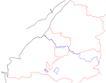 Bristol area with county boundaries, rivers.
 -
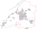 Bristol area with county boundaries, rivers, towns.
 -
 Bristol area with county boundaries, rivers, towns, roads and railways, no words.
 -
 Bristol area with most important/recognisable features.
 -
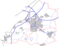
 Bristol area with county boundaries, rivers, towns, roads and railways.
 -
Cropped version -- this is the one I usually use for places of interest, etc.
-
County boundary.
-
Ward boundaries -- this is the one I usually use for wards/suburbs.
-
Roads and rivers.


