Mogote, Colorado
Jump to navigation
Jump to search

Mogote is an unincorporated community in Conejos County, in the U.S. state of Colorado.[1]
The site is located on Colorado Highway 17 south of the Conejos River and about four miles (6.4 km) west of Antonito.[2]
History
[edit | edit source]A post office called Mogote was established in 1897, and remained in operation until 1920.[3] The community was named for Mogotes near the town site.[4]
References
[edit | edit source]- ^ U.S. Geological Survey Geographic Names Information System: Mogote, Colorado
- ^ Antonito, Colorado, 7.5 Minute Topographic Quadrangle, USGS, 1967
- ^ Lua error in Module:Citation/CS1/Configuration at line 2172: attempt to index field '?' (a nil value).
- ^ Lua error in Module:Citation/CS1/Configuration at line 2172: attempt to index field '?' (a nil value).
Municipalities and communities of Conejos County, Colorado, United States | ||
|---|---|---|
| Towns | 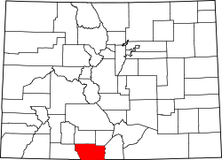 | |
| CDPs | ||
| Unincorporated communities | ||
| Ghost towns | ||
Lua error in Module:Coordinates at line 489: attempt to index field 'wikibase' (a nil value).
Lua error in Module:Authority_control at line 153: attempt to index field 'wikibase' (a nil value).
This Conejos County, Colorado state location article is a stub. You can help Wikipedia by expanding it. |