This module is rated as beta. It is considered ready for widespread use, but as it is still relatively new, it should be applied with some caution to ensure results are as expected.
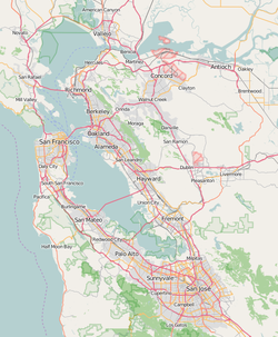
Location map of San Francisco Bay Area
name
San Francisco Bay Area
border coordinates
38.2033
-122.6445
←↕→
-121.5871
37.1897
map center
Lua error: callParserFunction: function "#coordinates" was not found.
Module:Location map/data/San Francisco Bay Area is a location map definition used to overlay markers and labels on an equirectangular projection map of San Francisco Bay Area. The markers are placed by latitude and longitude coordinates on the default map or a similar map image.
{{Location map many | San Francisco Bay Area
| width    = 250
| caption  = Two locations in the San Francisco Bay Area
| lat1_deg = 37.7917
| lon1_deg = -122.4131
| label1   = Grace Cathedral
| lat2_deg = 37.6019
| lon2_deg = -122.2047
| label2   = San Mateo–Hayward Bridge
}}
{{Location map+ | San Francisco Bay Area
| width   = 200
| caption = Four locations in the San Francisco Bay Area
| places  =
  {{Location map~ | San Francisco Bay Area
   | lat_deg = 37.7917
   | lon_deg = -122.4131
   | label   = [[Grace Cathedral, San Francisco|Grace Cathedral]]
  }}
  {{Location map~ | San Francisco Bay Area
   | lat_deg = 37.6019
   | lon_deg = -122.2047
   | label   = [[San Mateo–Hayward Bridge]]
  }}
  {{Location map~ | San Francisco Bay Area
   | lat_deg = 37.4220
   | lon_deg = -122.0841
   | label   = [[Google]]
  }}
  {{Location map~ | San Francisco Bay Area
   | lat_deg = 37.870
   | lon_deg = -122.259
   | label   = [[University of California, Berkeley|UC Berkeley]]
  }}
}}
return{name='San Francisco Bay Area',image='Location Map San Francisco Bay Area.png',image1='',top=38.2033,bottom=37.1897,left=-122.6445,right=-121.5871}