Module:Location map/data/Finland Satakunta
Jump to navigation
Jump to search
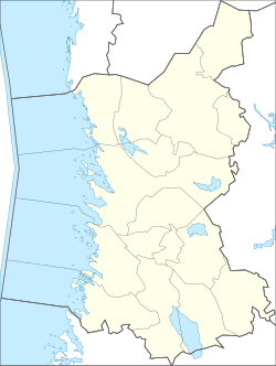
Map of Satakunta
File:Test Template Info-Icon - Version (2).svg Module documentation[view] [edit] [history] [purge]
.svg)
| name | Satakunta | |||
|---|---|---|---|---|
| border coordinates | ||||
| 62.3111 | ||||
| 20.7731 | ←↕→ | 23.0062 | ||
| 60.872 | ||||
| map center | Lua error: callParserFunction: function "#coordinates" was not found. | |||
| image | Finland Satakunta Region.svg
| |||

| ||||
Module:Location map/data/Finland Satakunta is a location map definition used to overlay markers and labels on an equirectangular projection map of Satakunta. The markers are placed by latitude and longitude coordinates on the default map or a similar map image.
Usage
These definitions are used by the following templates when invoked with parameter "Finland Satakunta":
{{Location map|Finland Satakunta |...}}{{Location map many|Finland Satakunta |...}}{{Location map+|Finland Satakunta |...}}{{Location map~|Finland Satakunta |...}}
Map definition
name = Satakunta- Name used in the default map caption
image = Finland Satakunta Region.svg- The default map image, without "Image:" or "File:"
top = 62.3111- Latitude at top edge of map, in decimal degrees
bottom = 60.872- Latitude at bottom edge of map, in decimal degrees
left = 20.7731- Longitude at left edge of map, in decimal degrees
right = 23.0062- Longitude at right edge of map, in decimal degrees
Precision
Longitude: from West to East this map definition covers 2.2331 degrees.
- At an image width of 200 pixels, that is 0.0112 degrees per pixel.
- At an image width of 1000 pixels, that is 0.0022 degrees per pixel.
Latitude: from North to South this map definition covers 1.4391 degrees.
- At an image height of 200 pixels, that is 0.0072 degrees per pixel.
- At an image height of 1000 pixels, that is 0.0014 degrees per pixel.
Examples using location map templates
Location map, using default map (image)
Pori
Pori (Satakunta)
{{Location map | Finland Satakunta
| width   = 200
| lat_deg = 61.48
| lon_deg = 21.80
| label   = Pori
}}
Location map many, using relief map (image1)
Two locations in Satakunta
{{Location map many | Finland Satakunta
| relief   = yes
| width    = 200
| caption  = Two locations in Satakunta
| lat1_deg = 61.48
| lon1_deg = 21.80
| label1   = Pori
| lat2_deg = 61.80
| lon2_deg = 22.39
| label2   = Kankaanpää
}}
See also
Location map templates
- Template:Location map, to display one mark and label using latitude and longitude
- Template:Location map many, to display up to nine marks and labels
- Template:Location map+, to display an unlimited number of marks and labels
Creating new map definitions