Manamedu
Manamedu | |
|---|---|
Village | |
| Lua error in Module:Location_map at line 411: Malformed coordinates value. | |
| Coordinates: Lua error in Module:Coordinates at line 489: attempt to index field 'wikibase' (a nil value). | |
| Country |  India India |
| State | Puducherry |
| District | Pondicherry |
| Taluk | Bahour |
| Commune | Bahour |
| Population (2001) | |
• Total | 36,983 |
| Languages | |
| • Official | French, Tamil, English |
| Time zone | UTC+5:30 (IST) |
| PIN | 607 402 |
| Telephone code | 0413 |
| Vehicle registration | PY-01 |
| Sex ratio | 50% ♂/♀ |
Manamedu is a village[1] in Bahour Commune of Bahour taluk in the Union Territory of Puducherry, India. It is one of the 11 Enclaves of Puducherry. Manmedu serves as a gateway to Pondicherry - Nellikuppam route. It lies on the banks of Pennaiyar River
History
[edit | edit source]The name Manamedu means "high area on the banks of a river". Manalmedu is being called as Manamedu.
Geography
[edit | edit source]Manamedu is connected to Bahour, its Commune Headquarters by Frontier Road (RC-21). A bridge is being constructed across Pennaiyar River at Manamedu. Upon its completion, Manamedu will serve has a vital point on the Pondicherry–Nellikuppam route.
Villages
[edit | edit source]Manamedu village panchayat consist of
- Manamedu
- Kaduvanur
Politics
[edit | edit source]Manamedu is a part of Nettapakkam (Union Territory Assembly constituency) which comes under Puducherry (Lok Sabha constituency)
Gallery
[edit | edit source]-
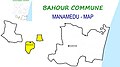 Map of Manamedu Village Panchayat
 -
 Overhead Water Tank, Manamedu, Bahour Commune


References
[edit | edit source]- ^ Lua error in Module:Citation/CS1/Configuration at line 2172: attempt to index field '?' (a nil value).