Moran Township, Michigan
Moran Township, Michigan | |
|---|---|
 Moran Township Office | |
,_MI_location2.png) Location within Mackinac County | |
| Lua error in Module:Location_map at line 411: Malformed coordinates value. | |
| Coordinates: Lua error in Module:Coordinates at line 489: attempt to index field 'wikibase' (a nil value). | |
| Country | United States |
| State | Michigan |
| County | Mackinac |
| Established | 1844 |
| Government | |
| • Supervisor | Susan Dionne |
| • Clerk | Kristine Vallier |
| Area | |
• Total | 134.42 sq mi (348.1 km2) |
| • Land | 127.57 sq mi (330.4 km2) |
| • Water | 6.85 sq mi (17.7 km2) |
| Elevation | 646 ft (197 m) |
| Population | |
• Total | 1,029 |
| • Density | 8.07/sq mi (3.12/km2) |
| Time zone | UTC-5 (Eastern (EST)) |
| • Summer (DST) | UTC-4 (EDT) |
| ZIP Codes | |
| Area code | 906 |
| FIPS code | 26-55480[1] |
| GNIS feature ID | 1626766[3] |
| Website | www |
Moran Township is a civil township of Mackinac County in the U.S. state of Michigan. The population was 1,029 at the 2020 census.[4]
Geography
[edit | edit source]The township is in central Mackinac County, along the northeast shore of Lake Michigan. The southeastern end of the township touches the Straits of Mackinac at the northeast end of the lake. The city of St. Ignace borders the township to the southeast.
According to the United States Census Bureau, the township has a total area of 134.42 square miles (348.15 km2), of which 127.57 square miles (330.40 km2) are land and 6.85 square miles (17.74 km2), or 5.10%, are water.[1]
Communities
[edit | edit source]- Brevort is an unincorporated community in the township on U.S. Route 2 at Lua error: callParserFunction: function "#coordinates" was not found., approximately 20 miles (32 km) northwest of St. Ignace.[5] The community is not a part of Brevort Township, which is adjacent to Moran Township on the north and east.
- Gros Cap is an unincorporated community in the township on Lake Michigan, approximately 5 miles (8 km) west of St. Ignace at Lua error: callParserFunction: function "#coordinates" was not found.[6]
- Ozark is a mostly unpopulated historic locale in the township at Lua error: callParserFunction: function "#coordinates" was not found..[7] It was the site for the charcoal kilns of the Martel Furnace Company and was a flag stop named "Johnson's" on the Duluth, South Shore and Atlantic Railway in 1882. A post office named Ozark operated from June 1884 until August 1966. The name was derived from the early French name for the place Aux Arc, meaning "at the bend."[8]
Attractions
[edit | edit source]- Father Marquette National Memorial
- Fred Dye Nature Sanctuary
- Hiawatha National Forest (part)
- North Country Trail (segment)
- St. Helena Island
Demographics
[edit | edit source]In 2020, the township population was 1,029.[4]
References
[edit | edit source]- ^ a b c Lua error in Module:Citation/CS1/Configuration at line 2172: attempt to index field '?' (a nil value).
- ^ Lua error in Module:Citation/CS1/Configuration at line 2172: attempt to index field '?' (a nil value).
- ^ U.S. Geological Survey Geographic Names Information System: Moran Township, Michigan
- ^ a b Lua error in Module:Citation/CS1/Configuration at line 2172: attempt to index field '?' (a nil value).
- ^ U.S. Geological Survey Geographic Names Information System: Brevort, Michigan
- ^ U.S. Geological Survey Geographic Names Information System: Gros Cap, Michigan
- ^ U.S. Geological Survey Geographic Names Information System: Ozark, Michigan
- ^ Lua error in Module:Citation/CS1/Configuration at line 2172: attempt to index field '?' (a nil value).
Municipalities and communities of Mackinac County, Michigan, United States | ||
|---|---|---|
| Cities | 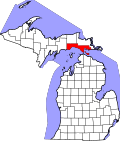 | |
| Civil townships | ||
| CDP | ||
| Other communities |
| |
| Indian reservations | ||
| Footnotes | ‡This populated place also has portions in an adjacent county or counties | |
Lua error in Module:Authority_control at line 153: attempt to index field 'wikibase' (a nil value).