Jrambar
Jump to navigation
Jump to search
Jrambar
Ջրամբար | |
|---|---|
| Lua error in Module:Location_map at line 411: Malformed coordinates value. | |
| Coordinates: Lua error in Module:Coordinates at line 489: attempt to index field 'wikibase' (a nil value). | |
| Country | Armenia |
| Province | Aragatsotn |
| Municipality | Aparan |
| Population (2011) | |
• Total | 146[1] |
| Time zone | UTC+4 |
| • Summer (DST) | UTC+5 |
Jrambar (Armenian: Ջրամբար) is a village in the Aparan Municipality of the Aragatsotn Province of Armenia. The local economy is based on the nearby Aparan dam and reservoir, which supplies the capital Yerevan with drinking water. Prior to the construction of the dam, the cultural monuments of the historic village of Zovuni (Poghos-Petros Church, Tukh Manuk shrine, and the S. Zoravar (General) Vardan Momikonyan Mausoleum) were moved stone-by-stone to higher ground to the east of the reservoir. The Zovuni cemetery sits to the east of the church, across a ravine.[2]
Gallery
[edit | edit source]-
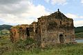 Zovuni Poghos-Petros Church
 -
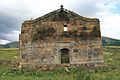 Zovuni Poghos-Petros Church
 -
 Zovuni Poghos-Petros Church
 -
 Zovuni Poghos-Petros Church
 -
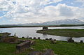 Cemetery and Zovuni Poghos-Petros Church
 -
 Cemetery
 -
 Shrine
 -
 Եկեղեցի ս. Պողոս - Պետրոս


References
[edit | edit source]- Jrambar at GEOnet Names Server
- Report of the results of the 2001 Armenian Census, Statistical Committee of Armenia
External links
[edit | edit source]Wikimedia Commons has media related to Jrambar.


 | This article about a location in Aragatsotn Province, Armenia is a stub. You can help Wikipedia by expanding it. |