Hawul
Hawul | |
|---|---|
 A beautiful mountain in Hawul, Borno State | |
| Lua error in Module:Infobox_mapframe at line 197: attempt to index field 'wikibase' (a nil value). | |
| Country | |
| State | Borno State |
| Time zone | UTC+1 (WAT) |
Hawul<phonos file="Hawul.ogg">Listen</phonos> is a Local Government Area of Borno State, Nigeria. It's located in the southern part of the state. It has an area of 2,098 km2 and a population of about 120,000 at the 2006 census.
The postal code of the area is 603.[1]
It is one of the four LGAs that constitute the Biu Emirate, a traditional state located in Borno State, Nigeria.[2]
Climate/Geography
[edit | edit source]Hawul LGA has an average temperature of 34 degrees Celsius and a total area of 2,098 square kilometers. The dry and rainy seasons are the two distinct seasons experienced by the LGA. In the Hawul LGA, the average wind speed is 10 km/h, and the average humidity is 21%.[3][4][5]
Gallery
[edit | edit source]-
 A beautiful clear water running between rocks in Hawul, Borno State
 -
 A beautiful water fall in Hawul, Borno State
 -
 A beautiful bird in Hawul, Borno State
 -
 A beautiful river in Hawul, Borno State
 -
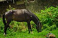 A beautiful horse eating grass in Hawul, Borno State


References
[edit | edit source]- ^ Lua error in Module:Citation/CS1/Configuration at line 2172: attempt to index field '?' (a nil value).
- ^ Lua error in Module:Citation/CS1/Configuration at line 2172: attempt to index field '?' (a nil value).
- ^ Lua error in Module:Citation/CS1/Configuration at line 2172: attempt to index field '?' (a nil value).
- ^ Lua error in Module:Citation/CS1/Configuration at line 2172: attempt to index field '?' (a nil value).
- ^ Lua error in Module:Citation/CS1/Configuration at line 2172: attempt to index field '?' (a nil value).
| Local government areas |  | |
|---|---|---|
This Borno State, Nigeria location article is a stub. You can help Wikipedia by expanding it. |