Hank, Netherlands
Hank | |
|---|---|
Village | |
| View on Hank View on Hank | |
| Lua error in Module:Location_map at line 411: Malformed coordinates value. | |
| Coordinates: Lua error in Module:Coordinates at line 489: attempt to index field 'wikibase' (a nil value). | |
| Country | Netherlands |
| Province | North Brabant |
| Municipality | Altena |
| Area | |
• Total | 24.60 km2 (9.50 sq mi) |
| Elevation | 0.4 m (1.3 ft) |
| Population (2021)[1] | |
• Total | 4,330 |
| • Density | 176/km2 (456/sq mi) |
| Time zone | UTC+1 (CET) |
| • Summer (DST) | UTC+2 (CEST) |
| Postal code | 4273[1] |
| Dialing code | 0162 |
Hank is a village in the Dutch province of North Brabant. It is a part of the municipality of Altena, and lies about 10 km (6 mi) north of Oosterhout. Hanks borders on De Biesbosch National Park.[3]
It was first mentioned in 1851 as De Hank, and means "place where fishers dry their nets".[4]
The area was poldered in 1188 and a little village called Heeraartswaarde and church were built. However the settlement was destroyed in the St. Elizabeth's flood of 1421. In 1863, a Catholic parish was founded as Mariapolder, and in 1896 a convent of the Sisters of Charity was established near the village. Hank was almost entirely destroyed in 1944 during World War II and was rebuilt after the war.[3]
Gallery
[edit | edit source]-
 Catholic church
 -
 Pond in Hank
 -
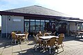 Cafeteria near the marina
 -
 House in Hank


References
[edit | edit source]- ^ a b c Lua error in Module:Citation/CS1/Configuration at line 2172: attempt to index field '?' (a nil value).
- ^ Lua error in Module:Citation/CS1/Configuration at line 2172: attempt to index field '?' (a nil value).
- ^ a b Lua error in Module:Citation/CS1/Configuration at line 2172: attempt to index field '?' (a nil value).
- ^ Lua error in Module:Citation/CS1/Configuration at line 2172: attempt to index field '?' (a nil value).
Lua error in Module:Authority_control at line 153: attempt to index field 'wikibase' (a nil value).