Hanimaadhoo
Hanimaadhoo
ހަނިމާދޫ | |
|---|---|
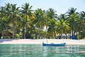
 Beach, north Hanimaadhoo | |
| Lua error in Module:Location_map at line 411: Malformed coordinates value. | |
| Coordinates: Lua error in Module:Coordinates at line 489: attempt to index field 'wikibase' (a nil value). | |
| Country | Maldives |
| Geographic atoll | Thiladhummathi Atoll |
| Administrative atoll | Haa Dhaalu Atoll |
| Distance to Malé | 288.84 km (179.48 mi) |
| Dimensions | |
| • Length | 6.800 km (4.225 mi) |
| • Width | 0.730 km (0.454 mi) |
| Population (2022)[1] | |
• Total | 2,664 |
| Time zone | UTC+05:00 (MST) |
Hanimaadhoo (Dhivehi: ހަނިމާދޫ) is one of the inhabited islands of Haa Dhaalu Atoll administrative division and geographically part of Thiladhummathi Atoll in the north of the Maldives.
Geography
[edit | edit source]The island is 288.84 km (179 mi; 156 nmi) north of the country's capital, Malé.[2]
Climate
[edit | edit source]The Hanomaadhoo Meteorological Observatory is located on this island. Many flight scientific research such as those investigating aerosol concentrations in the atmosphere and the Brown Cloud phenomenon have been initiated from Hanimaadhoo.
On 27 February 2025, Hanimaadhoo recorded a temperature of 35.8 °C (96.4 °F), which is the highest temperature to have ever been recorded in the Maldives.
| Climate data for Hanimaadhoo International Airport, (elevation 1.4 m (4.6 ft), 1991−2020 normals) | |||||||||||||
|---|---|---|---|---|---|---|---|---|---|---|---|---|---|
| Month | Jan | Feb | Mar | Apr | May | Jun | Jul | Aug | Sep | Oct | Nov | Dec | Year |
| Mean daily maximum °C (°F) | 30.8 (87.4) |
31.2 (88.2) |
32.1 (89.8) |
32.6 (90.7) |
32.0 (89.6) |
31.0 (87.8) |
30.7 (87.3) |
30.6 (87.1) |
30.7 (87.3) |
30.8 (87.4) |
30.8 (87.4) |
30.7 (87.3) |
31.2 (88.2) |
| Daily mean °C (°F) | 27.9 (82.2) |
28.2 (82.8) |
29.1 (84.4) |
29.8 (85.6) |
29.5 (85.1) |
28.8 (83.8) |
28.4 (83.1) |
28.3 (82.9) |
28.3 (82.9) |
28.2 (82.8) |
28.1 (82.6) |
28.0 (82.4) |
28.6 (83.5) |
| Mean daily minimum °C (°F) | 24.5 (76.1) |
24.6 (76.3) |
25.6 (78.1) |
26.6 (79.9) |
26.5 (79.7) |
25.8 (78.4) |
25.4 (77.7) |
25.5 (77.9) |
25.4 (77.7) |
25.2 (77.4) |
24.8 (76.6) |
24.6 (76.3) |
25.4 (77.7) |
| Average precipitation mm (inches) | 38.7 (1.52) |
29.4 (1.16) |
32.7 (1.29) |
67.2 (2.65) |
234.5 (9.23) |
229.2 (9.02) |
260.5 (10.26) |
221.5 (8.72) |
174.3 (6.86) |
198.5 (7.81) |
172.4 (6.79) |
107.8 (4.24) |
1,766.7 (69.56) |
| Average precipitation days (≥ 0.1 mm) | 3.0 | 2.7 | 2.9 | 5.5 | 13.4 | 17.1 | 16.3 | 15.0 | 13.1 | 12.8 | 10.5 | 7.3 | 119.6 |
| Source: NOAA[3] | |||||||||||||
Demography
[edit | edit source]Islanders from Hathifushi and Hondaidhoo have been relocated to Hanimaadhoo in the recent years.
| Year | Pop. | ±% |
|---|---|---|
| 2006 | 1,184 | — |
| 2014 | 1,618 | +36.7% |
| 2022 | 2,664 | +64.6% |
| 2006-2014: Census populations Source: [4][1] | ||
Economy
[edit | edit source]The island is planned to be one of the developmental centres of the newly planned Mathi-Uthuru Province.
Tourism Sector
[edit | edit source]The island is slowly developing into a tourist hot spot North Of the Maldives.
Currently hanimaadhoo have several guest houses, which caters to national and international tourists.
Transport
[edit | edit source]The island is the site of Hanimaadhoo Airport, one of the few international airports of the Maldives.
Gallery
[edit | edit source]-
 Main street
 -
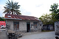 Old house made of coral bricks
 -
 West coast
 -
 West coast
 -
 Banana plant alley, north island


References
[edit | edit source]- ^ a b Lua error in Module:Citation/CS1/Configuration at line 2172: attempt to index field '?' (a nil value).
- ^ Lua error in Module:Citation/CS1/Configuration at line 2172: attempt to index field '?' (a nil value).
- ^ Lua error in Module:Citation/CS1/Configuration at line 2172: attempt to index field '?' (a nil value).
- ^ Lua error in Module:Citation/CS1/Configuration at line 2172: attempt to index field '?' (a nil value).
This Maldives location article is a stub. You can help Wikipedia by expanding it. |