Guhrow
Jump to navigation
Jump to search
Guhrow
Góry | |
|---|---|
Location of Guhrow
within Spree-Neiße district 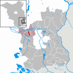 | |
| Lua error in Module:Infobox_mapframe at line 197: attempt to index field 'wikibase' (a nil value). | |
| Lua error in Module:Location_map at line 411: Malformed coordinates value. | |
| Coordinates: Lua error in Module:Coordinates at line 489: attempt to index field 'wikibase' (a nil value). | |
| Country | Germany |
| State | Brandenburg |
| District | Spree-Neiße |
| Municipal assoc. | Burg (Spreewald) |
| Government | |
| • Mayor (2024–29) | Frank Engelking[1] |
| Area | |
• Total | 6.62 km2 (2.56 sq mi) |
| Elevation | 58 m (190 ft) |
| Population (Lua error in Module:Settlement_Wikidata at line 197: attempt to index field 'wikibase' (a nil value).)Lua error in Module:Settlement_Wikidata at line 197: attempt to index field 'wikibase' (a nil value). | |
• Total | Lua error in Module:Settlement_Wikidata at line 197: attempt to index field 'wikibase' (a nil value). |
| Time zone | UTC+01:00 (CET) |
| • Summer (DST) | UTC+02:00 (CEST) |
| Postal codes | 03096 |
| Dialling codes | 035606 |
| Vehicle registration | SPN |
| Website | www.amt-burg-spreewald.de |
Guhrow (Lower Sorbian: Góry) is a municipality in the district of Spree-Neiße, in Lower Lusatia, Brandenburg, Germany.
History
[edit | edit source]From 1815 to 1947, Guhrow was part of the Prussian Province of Brandenburg.
After World War II, Guhrow was incorporated into the State of Brandenburg from 1947 to 1952 and the Bezirk Cottbus of East Germany from 1952 to 1990. Since 1990, Guhrow has been part of Brandenburg.
Demography
[edit | edit source]Guhrow: Population development within the current boundaries (2013)[2] | |||||||||||||||||||||||||||||||||||||||||||||||||||||||||||||||||||||||||||||||||||||||||||||||||||||||||||||||||||||||||||||||
|
| ||||||||||||||||||||||||||||||||||||||||||||||||||||||||||||||||||||||||||||||||||||||||||||||||||||||||||||||||||||||||||||||
References
[edit | edit source]- ^ Bürgermeisterwahl 2024, Land Brandenburg. Retrieved 10 July 2024.
- ^ Detailed data sources are to be found in the Wikimedia Commons.Population Projection Brandenburg at Wikimedia Commons
Lua error in Module:Authority_control at line 153: attempt to index field 'wikibase' (a nil value).