Gebsattel
Jump to navigation
Jump to search
Gebsattel | |
|---|---|
 Gebsattel Castle | |
 Coat of arms | |
Location of Gebsattel
within Ansbach district 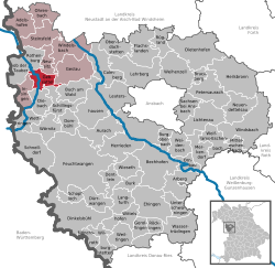 | |
| Lua error in Module:Infobox_mapframe at line 197: attempt to index field 'wikibase' (a nil value). | |
| Lua error in Module:Location_map at line 411: Malformed coordinates value. | |
| Coordinates: Lua error in Module:Coordinates at line 489: attempt to index field 'wikibase' (a nil value). | |
| Country | Germany |
| State | Bavaria |
| Admin. region | Mittelfranken |
| District | Ansbach |
| Municipal assoc. | Rothenburg ob der Tauber |
| Subdivisions | 3 Ortsteile |
| Government | |
| • Mayor (2020–26) | Gerd Rößler[1] |
| Area | |
• Total | 19.12 km2 (7.38 sq mi) |
| Elevation | 378 m (1,240 ft) |
| Population (Lua error in Module:Settlement_Wikidata at line 197: attempt to index field 'wikibase' (a nil value).)Lua error in Module:Settlement_Wikidata at line 197: attempt to index field 'wikibase' (a nil value). | |
• Total | Lua error in Module:Settlement_Wikidata at line 197: attempt to index field 'wikibase' (a nil value). |
| Time zone | UTC+01:00 (CET) |
| • Summer (DST) | UTC+02:00 (CEST) |
| Postal codes | 91607 |
| Dialling codes | 09861 |
| Vehicle registration | AN |
| Website | www.gebsattel.de |
Gebsattel is a municipality in the district of Ansbach in Bavaria in Germany. It lies on the Tauber River.
Main sights
[edit | edit source]-
 Catholic church of Saint Laurentius
 -
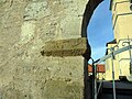 One of the old gates

-26032012.JPG)
Neighborhoods, districts
[edit | edit source]Gebsattel has nine neighborhoods or districts:[2]
- Bockenfeld
- Eckartshof
- Gebsattel
- Kirnberg
- Pleikartshof
- Rödersdorf
- Speierhof
- Wasenmühle
- Wildenhof
References
[edit | edit source]- ^ Liste der ersten Bürgermeister/Oberbürgermeister in kreisangehörigen Gemeinden, Bayerisches Landesamt für Statistik, 15 July 2021.
- ^ Lua error in Module:Citation/CS1/Configuration at line 2172: attempt to index field '?' (a nil value).
External links
[edit | edit source]
Wikimedia Commons has media related to Gebsattel.
- Map of the municipality
- Lua error in Module:Citation/CS1/Configuration at line 2172: attempt to index field '?' (a nil value).
- Gebsattel: Official statistics compiled by the Bavarian State Office of Statistics (LfStat)
Lua error in Module:Authority_control at line 153: attempt to index field 'wikibase' (a nil value).
This Ansbach district location article is a stub. You can help Wikipedia by expanding it. |