De Rips
De Rips | |
|---|---|
Village | |
.jpg) Houses in De Rips | |
| Lua error in Module:Location_map at line 411: Malformed coordinates value. | |
| Coordinates: Lua error in Module:Coordinates at line 489: attempt to index field 'wikibase' (a nil value). | |
| Country | Netherlands |
| Province | North Brabant |
| Municipality | Gemert-Bakel |
| Established | 1921 |
| Area | |
• Total | 25.57 km2 (9.87 sq mi) |
| Elevation | 28 m (92 ft) |
| Population (2021)[1] | |
• Total | 1,160 |
| • Density | 45.4/km2 (117/sq mi) |
| Time zone | UTC+1 (CET) |
| • Summer (DST) | UTC+2 (CEST) |
| Postal code | 5764[1] |
| Dialing code | 0493 |
De Rips is a village east of Helmond and Eindhoven in southern part of the Netherlands. Until the late 1990s it formed the municipality of Bakel and Milheeze alongside Milheeze and Bakel, but in 1997 it was forced to merge with the larger Gemert municipality.[3]
The village was first mentioned in 1544 as Ripse Paal, and refers to a border pole close to the stream Rips.[4]
De Rips was located in the Peel, a large heath area. In 1871, 400 hectares (990 acres) was bought by Cornelis Carp who built a farm in 1875 on land which was named after the border pole. The land was cultivated and more farms were built. The village was founded in 1921 by the Heidemij (nowadays: Arcadis) as a planned settlement with church, school and houses.[3]
Gallery
[edit | edit source]-
 Farm in De Rips
 -
 Clergy house
 -
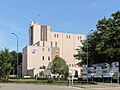 Factory


References
[edit | edit source]- ^ a b c Lua error in Module:Citation/CS1/Configuration at line 2172: attempt to index field '?' (a nil value).
- ^ Lua error in Module:Citation/CS1/Configuration at line 2172: attempt to index field '?' (a nil value).
- ^ a b Lua error in Module:Citation/CS1/Configuration at line 2172: attempt to index field '?' (a nil value).
- ^ Lua error in Module:Citation/CS1/Configuration at line 2172: attempt to index field '?' (a nil value).
Lua error in Module:Authority_control at line 153: attempt to index field 'wikibase' (a nil value).
This North Brabant location article is a stub. You can help Wikipedia by expanding it. |