Cord, Arkansas
Jump to navigation
Jump to search
Cord, Arkansas | |
|---|---|
| Lua error in Module:Location_map at line 411: Malformed coordinates value. | |
| Coordinates: Lua error in Module:Coordinates at line 489: attempt to index field 'wikibase' (a nil value). | |
| Country | United States |
| State | Arkansas |
| County | Independence |
| Elevation | 335 ft (102 m) |
| Time zone | UTC-6 (Central (CST)) |
| • Summer (DST) | UTC-5 (CDT) |
| ZIP code | 72524 |
| Area code | 870 |
| GNIS feature ID | 48039[1] |
Cord is an unincorporated community in Independence County, Arkansas, United States. Cord is located at the junction of Arkansas highways 37 and 122, 9.5 miles (15.3 km) northeast of Newark. Cord has a post office with ZIP code 72524.[2]
Cord is served by Cedar Ridge School District. It was formed on July 1, 2004, from the consolidation of the Cord Charlotte School District and the Newark School District.[3]
References
[edit | edit source]- ^ a b U.S. Geological Survey Geographic Names Information System: Cord, Arkansas
- ^ ZIP Code Lookup Archived 2012-09-16 at the Wayback Machine
- ^ "ConsolidationAnnex_from_1983.xls Archived 2015-09-12 at the Wayback Machine." Arkansas Department of Education. Retrieved on October 13, 2017.
Municipalities and communities of Independence County, Arkansas, United States | ||
|---|---|---|
| Cities | 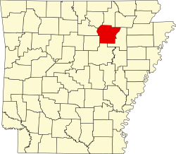 | |
| Towns | ||
| CDPs | ||
| Other unincorporated communities | ||
| Footnotes | ‡This populated place also has portions in an adjacent county or counties | |
Lua error in Module:Authority_control at line 153: attempt to index field 'wikibase' (a nil value).
This article about a location in Independence County, Arkansas is a stub. You can help Wikipedia by expanding it. |