Castenray
Jump to navigation
Jump to search
Castenray | |
|---|---|
Village | |
 Community house | |
| Lua error in Module:Location_map at line 411: Malformed coordinates value. | |
| Coordinates: Lua error in Module:Coordinates at line 489: attempt to index field 'wikibase' (a nil value). | |
| Country | Netherlands |
| Province | Limburg |
| Municipality | Venray |
| Area | |
• Total | 9.50 km2 (3.67 sq mi) |
| Elevation | 26 m (85 ft) |
| Population (2021)[1] | |
• Total | 835 |
| • Density | 87.9/km2 (228/sq mi) |
| Time zone | UTC+1 (CET) |
| • Summer (DST) | UTC+2 (CEST) |
| Postal code | 5811[1] |
| Dialing code | 0478 |
Castenray is a village in the Dutch province of Limburg. It is a part of the municipality of Venray, and lies about 17 km northwest of Venlo.
The village was first mentioned in 1409 as Casterloe. The etymology is unclear.[3] Castenray was home to 211 people in 1840.[4]
Gallery
[edit | edit source]-
 St Matthias Church
 -
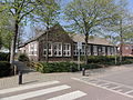 School in Castenray
 -
 Farm in Castenray


References
[edit | edit source]- ^ a b c Lua error in Module:Citation/CS1/Configuration at line 2172: attempt to index field '?' (a nil value).
- ^ Lua error in Module:Citation/CS1/Configuration at line 2172: attempt to index field '?' (a nil value).
- ^ Lua error in Module:Citation/CS1/Configuration at line 2172: attempt to index field '?' (a nil value).
- ^ Lua error in Module:Citation/CS1/Configuration at line 2172: attempt to index field '?' (a nil value).

Wikimedia Commons has media related to [[commons:Lua error in Module:WikidataIB at line 506: attempt to index field 'wikibase' (a nil value).|Lua error in Module:WikidataIB at line 506: attempt to index field 'wikibase' (a nil value).]].
Lua error in Module:Authority_control at line 153: attempt to index field 'wikibase' (a nil value).
.svg) | This Dutch Limburg location article is a stub. You can help Wikipedia by expanding it. |