Albisheim
Albisheim | |
|---|---|
| File:Blick über Albisheim-2.jpg | |
|
Coat of arms of Albisheim Coat of arms | |
Location of Albisheim
within Donnersbergkreis district | |
| Lua error in Module:Infobox_mapframe at line 197: attempt to index field 'wikibase' (a nil value). | |
| Lua error in Module:Location_map at line 411: Malformed coordinates value. | |
| Coordinates: Lua error in Module:Coordinates at line 489: attempt to index field 'wikibase' (a nil value). | |
| Country | Germany |
| State | Rhineland-Palatinate |
| District | Donnersbergkreis |
| Municipal assoc. | Göllheim |
| Government | |
| • Mayor (2019–24) | Ronald Zelt[1] |
| Area | |
• Total | 10.74 km2 (4.15 sq mi) |
| Highest elevation | 170 m (560 ft) |
| Lowest elevation | 150 m (490 ft) |
| Population (Lua error in Module:Settlement_Wikidata at line 197: attempt to index field 'wikibase' (a nil value).)Lua error in Module:Settlement_Wikidata at line 197: attempt to index field 'wikibase' (a nil value). | |
• Total | Lua error in Module:Settlement_Wikidata at line 197: attempt to index field 'wikibase' (a nil value). |
| Time zone | UTC+01:00 (CET) |
| • Summer (DST) | UTC+02:00 (CEST) |
| Postal codes | 67308 |
| Dialling codes | 06355 |
| Vehicle registration | KIB |
| Website | albisheim.de |
Albisheim is a municipality in the Donnersbergkreis, Rhineland-Palatinate, Germany. It is part of the Zellertal region.
Geography
[edit | edit source]The village is located in the part of the Pfrimm Valley, known as Zellertal, which forms part of the Alzey Hills. Neighbouring municipalities are Stetten, Einselthum, Zellertal, Immesheim, Rüssingen, Marnheim and Gauersheim. Besides the village proper, the inhabited places Bahnhof Albisheim, Heyerhof and Pfortmühle are part of the municipality.[2]
History
[edit | edit source]Remnants indicate a celtic settlement. In 835 the village was given to Prüm Abbey by emperor Louis the German. It appears as property of Prüm Abbey in 893. In early medieval times it belonged to the Duchy of Franconia. Otterberg Abbey held properties here since the 11th century.[3] Early on Albisheim became a market town.
Until the 18th century the village was ruled by the House of Nassau-Weilburg and administrated from Kirchheimbolanden.
After the War of the First Coalition Albisheim was occupied and later annexed by France with the Treaty of Campo Formio in 1797. From 1798 to 1814 it belonged to the French Departement du Mont-Tonnerre. After the Congress of Vienna the region was first given to Austria (1815) and later to Bavaria (1816).
After World War II Albisheim became part of Rhineland-Palatinate (1946). Since 1969 it belongs to the Donnersbergkreis district.
Politics
[edit | edit source]Council
[edit | edit source]The village council is composed of 16 members who were elected in a personalized proportional representation in the local elections on June 9, 2024, and the honorary mayor as chairman.[4]
Heraldry
[edit | edit source]The coat of arms shows Saint Peter.
Culture and sights
[edit | edit source]Festivals
[edit | edit source]Every year on the third weekend of September the Köngisfest ("King's festival") is held. The tradition can be traced back to the year 1222. There is also an end of winter celebration, regionally known as Stabaus.
Buildings
[edit | edit source]- jewish cemetery
- houses along the main street (Hauptstraße)
- Protestant church from 1792,
- historic town hall, a classicist building from 1832
- Warteturm (first mentioned in 1551)
-
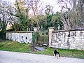 jewish cemetery
 -
 Hauptstraße 51
 -
 protestant church
 -
Town hall
-
Warteturm


_in_KIB.svg)
Nature
[edit | edit source]There are six protected natural monuments and two nature reserves (Saukopf and Osterberg) in the municipality.
Economy and infrastructure
[edit | edit source]Economy
[edit | edit source]Albisheim is part of the Palatinate (wine region).
Infrastructure
[edit | edit source]Roads
[edit | edit source]federal road B47 bypasses Albisheim and connects it to Worms. The A63 can be reached 7 km (4.5 mi) to the northeast.
Public transit
[edit | edit source]Albisheim station along the Zeller Valley Railway has not been served by regular passenger trains since 1983. Weekend-trains ran from 2001 to 2016.
Bus lines 904 and 921 of the VRN serve Albisheim.[5]
References
[edit | edit source]- ^ Direktwahlen 2019, Donnersbergkreis, Landeswahlleiter Rheinland-Pfalz, accessed 9 August 2021.
- ^ Statistisches Landesamt Rheinland-Pfalz (Hrsg.): Amtliches Verzeichnis der Gemeinden und Gemeindeteile. Stand: Februar 2022. p. 135 (PDF; 3,3 MB).
- ^ Jürgen Keddigkeit, Michael Werling, Rüdiger Schulz und Charlotte Lagemann: Otterberg, St. Maria. Zisterzienserabtei Otterburg. In: Jürgen Keddigkeit, Matthias Untermann, Sabine Klapp, Charlotte Lagemann, Hans Ammerich (Hg.): Pfälzisches Klosterlexikon. Handbuch der pfälzischen Klöster, Stifte und Kommenden, Band 3: M–R. Institut für pfälzische Geschichte und Volkskunde. Kaiserslautern 2015, ISBN 978-3-927754-78-2, S. 524–587 (538).
- ^ Lua error in Module:Citation/CS1/Configuration at line 2172: attempt to index field '?' (a nil value).
- ^ Lua error in Module:Citation/CS1/Configuration at line 2172: attempt to index field '?' (a nil value).
Lua error in Module:Authority_control at line 153: attempt to index field 'wikibase' (a nil value).