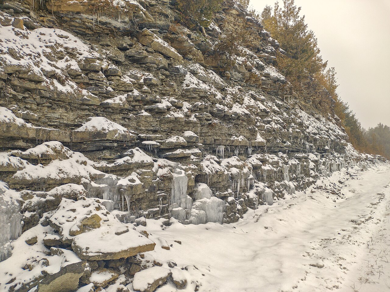
File:Verulam Formation.jpg
Commons is a freely licensed media file repository. You can help.
Summary
| DescriptionVerulam Formation.jpg |
English: Verulam Formation outcropping along Kirkfield Road. |
| Date | Taken on 12 January 2023 |
| Source |
Own work |
| Author | The Cosmonaut |
| Permission (Reusing this file) |
This file is licensed under the Creative Commons Attribution-Share Alike 2.5 Canada license.
|
| Camera location | 44° 29′ 25.98″ N, 78° 56′ 46.14″ W | View this and other nearby images on: OpenStreetMap |
|---|
This image has been assessed using the Quality image guidelines and is considered a Quality image.
العربية ∙ جازايرية ∙ беларуская ∙ беларуская (тарашкевіца) ∙ български ∙ বাংলা ∙ català ∙ čeština ∙ Cymraeg ∙ Deutsch ∙ Schweizer Hochdeutsch ∙ Zazaki ∙ Ελληνικά ∙ English ∙ Esperanto ∙ español ∙ eesti ∙ euskara ∙ فارسی ∙ suomi ∙ français ∙ galego ∙ עברית ∙ हिन्दी ∙ hrvatski ∙ magyar ∙ հայերեն ∙ Bahasa Indonesia ∙ italiano ∙ 日本語 ∙ Jawa ∙ ქართული ∙ Qaraqalpaqsha ∙ 한국어 ∙ kurdî ∙ кыргызча ∙ Latina ∙ Lëtzebuergesch ∙ lietuvių ∙ македонски ∙ മലയാളം ∙ मराठी ∙ Bahasa Melayu ∙ Nederlands ∙ ਪੰਜਾਬੀ ∙ Norfuk / Pitkern ∙ polski ∙ português ∙ português do Brasil ∙ rumantsch ∙ română ∙ русский ∙ sicilianu ∙ slovenčina ∙ slovenščina ∙ shqip ∙ српски / srpski ∙ svenska ∙ தமிழ் ∙ తెలుగు ∙ ไทย ∙ Tagalog ∙ toki pona ∙ Türkçe ∙ українська ∙ oʻzbekcha / ўзбекча ∙ vèneto ∙ Tiếng Việt ∙ 中文 ∙ 中文(简体) ∙ 中文(繁體) ∙ +/− |
Captions
Items portrayed in this file
depicts
12 January 2023
44°29'25.980"N, 78°56'46.140"W
0.00833333333333333333 second
1.8
5.53 millimetre
102
image/jpeg
File history
Click on a date/time to view the file as it appeared at that time.
| Date/Time | Thumbnail | Dimensions | User | Comment | |
|---|---|---|---|---|---|
| current | 04:31, 11 April 2024 | 4,010 × 3,000 (7.87 MB) | wikimediacommons>The Cosmonaut | brightness |
File usage
The following page uses this file:
Metadata
This file contains additional information, probably added from the digital camera or scanner used to create or digitize it.
If the file has been modified from its original state, some details may not fully reflect the modified file.
| Image title | |
|---|---|
| Camera manufacturer | motorola |
| Camera model | motorola one hyper |
| Copyright holder | |
| Exposure time | 1/120 sec (0.0083333333333333) |
| F-number | f/1.8 |
| ISO speed rating | 102 |
| Date and time of data generation | 11:04, 12 January 2023 |
| Lens focal length | 5.53 mm |
| Latitude | 44° 29′ 25.99″ N |
| Longitude | 78° 56′ 46.14″ W |
| Altitude | 223.9 meters above sea level |
| Orientation | Normal |
| Horizontal resolution | 300 dpi |
| Vertical resolution | 300 dpi |
| Software used | darktable 4.6.1 |
| File change date and time | 00:30, 11 April 2024 |
| Y and C positioning | Centered |
| Exposure Program | Not defined |
| Exif version | 2.2 |
| Date and time of digitizing | 11:04, 12 January 2023 |
| Meaning of each component |
|
| Shutter speed | 6.906 |
| APEX aperture | 1.69 |
| APEX brightness | 0 |
| Exposure bias | 0 |
| Maximum land aperture | 1.69 APEX (f/1.8) |
| Metering mode | Average |
| Light source | D65 |
| Flash | Flash did not fire, compulsory flash suppression |
| DateTime subseconds | 354149 |
| DateTimeOriginal subseconds | 354 |
| DateTimeDigitized subseconds | 354149 |
| Supported Flashpix version | 1 |
| Color space | sRGB |
| Scene type | 0 |
| Exposure mode | Auto exposure |
| White balance | Auto white balance |
| Digital zoom ratio | 1 |
| Focal length in 35 mm film | 0 mm |
| Scene capture type | Standard |
| GPS time (atomic clock) | 16:04 |
| GPS date | 12 January 2023 |
| GPS tag version | 0.0.2.2 |
| Rating (out of 5) | 0 |