
File:Timfi panorama.jpg
Jump to navigation
Jump to search
Size of this preview: 800 × 277 pixels. Other resolutions: 320 × 111 pixels | 640 × 222 pixels | 1,024 × 355 pixels | 1,280 × 443 pixels | 2,560 × 887 pixels | 8,126 × 2,814 pixels.


Original file (8,126 × 2,814 pixels, file size: 3.96 MB, MIME type: image/jpeg)

Summary
| Description |
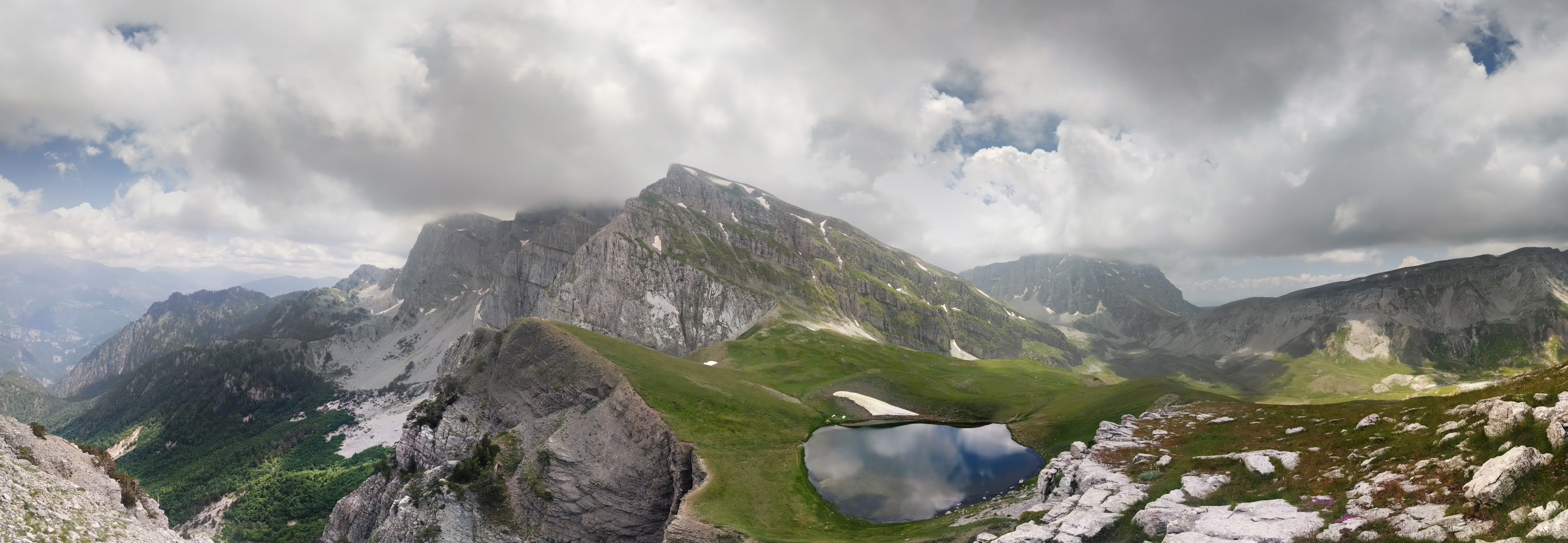
Ελληνικά: Όλη η δυτική Τύμφη σε μια φωτoγραφία. Διακρίνονται αριστερά η Γκαμήλα μέσα στα σύννεφα (2497μ), στο κέντρο δεσπόζει ο Πλόσκος (2377μ) και από κάτω του η Δρακόλιμνη, πιο δεξιά στο βάθος η Αστράκα (2436μ) και τέρμα αριστερά ο Λάπατος (2251μ). Στο διάσελο μεταξύ Αστράκας και Λάπατου οριακά διακρίνεται το καταφύγιο Δ. Γεωργούλης (1950μ).
Η σύνθεση του πανοράματος (photosphere) έγινε από 19 διαδοχικές λήψεις, από ανώνυμη κορυφή δυτικά της Δρακόλιμνης (2070μ) σε ένα Motorola Moto X. Τελική ανάλυση 23MP. Δεν έχουν εφαρμοστεί ψηφιακά φίλτρα.
English: Panorama of Tymfi, with Gamila (2.497 m) in clouds, Ploskos (2.377 m) in the centre and below it Dracolimni, and behind to the right Astraka (2.436 m.) and to the left Lapatos (2.251 m)
|
|||
| Date | ||||
| Source | Own work | |||
| Author | Nikos Mouratidis |
| Camera location |  | View this and other nearby images on: OpenStreetMap |  |
|---|

Licensing
I, the copyright holder of this work, hereby publish it under the following license:


This file is licensed under the Creative Commons Attribution-Share Alike 4.0 International license.
- You are free:
- to share – to copy, distribute and transmit the work
- to remix – to adapt the work
- Under the following conditions:
- attribution – You must give appropriate credit, provide a link to the license, and indicate if changes were made. You may do so in any reasonable manner, but not in any way that suggests the licensor endorses you or your use.
- share alike – If you remix, transform, or build upon the material, you must distribute your contributions under the same or compatible license as the original.

|
This image was uploaded as part of Wiki Loves Earth 2016.
|
 |

|
This image has been assessed using the Quality image guidelines and is considered a Quality image.
|
File history
Click on a date/time to view the file as it appeared at that time.
| Date/Time | Thumbnail | Dimensions | User | Comment | |
|---|---|---|---|---|---|
| current | 03:08, 21 May 2016 | | 8,126 × 2,814 (3.96 MB) | wikimediacommons>Mouridis | User created page with UploadWizard |
File usage
The following page uses this file:
