
File:Taiwan Strait.png
Jump to navigation
Jump to search
Size of this preview: 510 × 599 pixels. Other resolutions: 204 × 240 pixels | 409 × 480 pixels | 681 × 800 pixels.


Original file (681 × 800 pixels, file size: 207 KB, MIME type: image/png)

Summary
| Description |
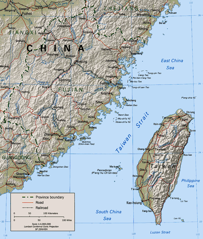
English: Map of the Taiwan Strait 閩南語 / Bân-lâm-gí:Tâi-uân Hái-kiap. 臺灣海峽 中文(中国大陆):台湾海峡地图 中文(简体):台湾海峡地图 中文(臺灣):臺灣海峽地圖 中文(香港):臺灣海峽地圖 中文(繁體):臺灣海峽地圖 |
|||
| Source | Perry-Castañeda Library (Cleaned up version of en:Image:Taiwan straits.jpg, which is a work by the United States' government.) | |||
| Author | "The following maps were produced by the U.S. Central Intelligence Agency, unless otherwise indicated." | |||
| Permission (Reusing this file) |
|

Licensing

|
This image is a work of a Central Intelligence Agency employee, taken or made as part of that person's official duties. As a Work of the United States Government, this image or media is in the public domain in the United States.
|

|
File history
Click on a date/time to view the file as it appeared at that time.
| Date/Time | Thumbnail | Dimensions | User | Comment | |
|---|---|---|---|---|---|
| current | 03:31, 15 January 2005 | | 681 × 800 (207 KB) | wikimediacommons>MikeEdwards~commonswiki | Map of the Taiwan Strait -- pulled from Wikipedia for use in Wikinews{{GFDL}} |
File usage
The following 18 pages use this file:
- 1995
- Cross-strait relations
- Fifth Chen–Chiang summit
- Fujian–Taiwan relationship
- Pingtan Island
- Second Sino-Japanese War
- Second Taiwan Strait Crisis
- Sino-Soviet split
- Tancheng, Pingtan County
- Third Taiwan Strait Crisis
- Wade–Giles
- Talk:Administrative divisions of Taiwan
- User:Effer/China as an emerging superpower
- User:HarbourCard0/sandbox
- User:Mikepanhu/temp
- MyWiki:WikiProject Military history/News/May 2024/Book reviews
- Special:Badtitle/NS100:Taiwan/Atlas
- Special:Badtitle/NS100:Taiwan/Geography
