File:Pinconning River MI map.png
Jump to navigation
Jump to search
Size of this preview: 800 × 594 pixels. Other resolutions: 320 × 238 pixels | 640 × 475 pixels | 1,024 × 760 pixels | 1,280 × 950 pixels | 2,560 × 1,900 pixels | 2,837 × 2,106 pixels.
Original file (2,837 × 2,106 pixels, file size: 213 KB, MIME type: image/png)
Summary
| Description |
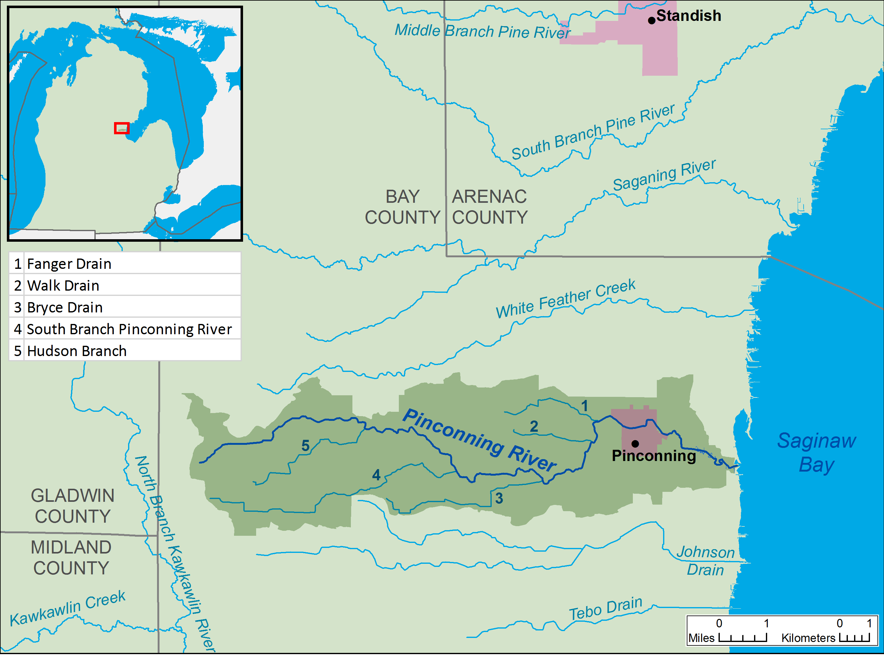
English: A map of the Pinconning River and its watershed (USGS HUC-12 code 040801020107), in northern Bay County in Michigan |
| Date | |
| Source | Own work, data from The National Map |
| Author | Tim Kiser (User:TimK MSI) |
Licensing
I, the copyright holder of this work, hereby publish it under the following license:
This file is licensed under the Creative Commons Attribution-Share Alike 3.0 Unported license.
- You are free:
- to share – to copy, distribute and transmit the work
- to remix – to adapt the work
- Under the following conditions:
- attribution – You must give appropriate credit, provide a link to the license, and indicate if changes were made. You may do so in any reasonable manner, but not in any way that suggests the licensor endorses you or your use.
- share alike – If you remix, transform, or build upon the material, you must distribute your contributions under the same or compatible license as the original.
File history
Click on a date/time to view the file as it appeared at that time.
| Date/Time | Thumbnail | Dimensions | User | Comment | |
|---|---|---|---|---|---|
| current | 11:56, 21 August 2015 | No thumbnail | 2,837 × 2,106 (213 KB) | wikimediacommons>TimK MSI | {{Information |Description ={{en|1=A map of the Pinconning River and its watershed (USGS HUC-12 code 040801020107), in northern Bay County in Michigan}} |Source =Own work, data fro... |
File usage
The following page uses this file: