File:PhilaDistrict.PNG
Jump to navigation
Jump to search
No higher resolution available.
PhilaDistrict.PNG (536 × 575 pixels, file size: 21 KB, MIME type: image/png)
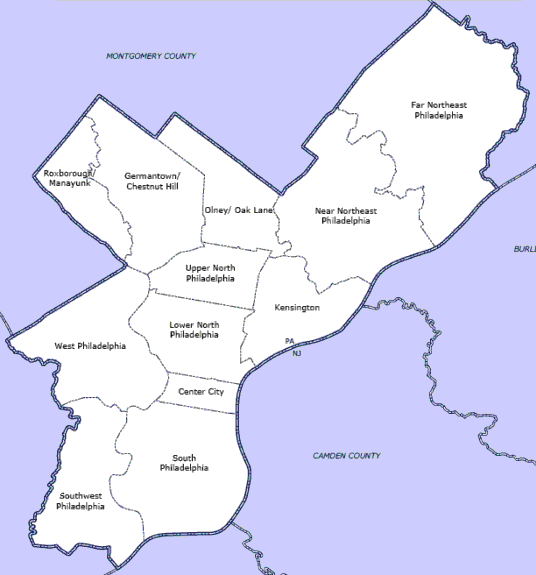
Summary
| Description |
English: Map of Philadelphia County highlighting planning districts |
| Date | 5 September 2005 (original upload date) |
| Source | Transferred from en.wikipedia to Commons by Apollo1758 using CommonsHelper. |
| Author | Boothy443 at English Wikipedia |

|
This locator map image could be re-created using vector graphics as an SVG file. This has several advantages; see Commons:Media for cleanup for more information. If an SVG form of this image is available, please upload it and afterwards replace this template with
{{vector version available|new image name}}.It is recommended to name the SVG file “PhilaDistrict.svg”—then the template Vector version available (or Vva) does not need the new image name parameter. |
Licensing
| This work has been released into the public domain by its author, Boothy443 at English Wikipedia. This applies worldwide. In some countries this may not be legally possible; if so: Boothy443 grants anyone the right to use this work for any purpose, without any conditions, unless such conditions are required by law. |
Original upload log
The original description page was here. All following user names refer to en.wikipedia.
- 2005-09-05 02:45 Boothy443 536×575× (21358 bytes) Map of Philadelphia County highlighting planning districts
File history
Click on a date/time to view the file as it appeared at that time.
| Date/Time | Thumbnail | Dimensions | User | Comment | |
|---|---|---|---|---|---|
| current | 01:11, 25 September 2010 | | 536 × 575 (21 KB) | wikimediacommons>Apollo1758 | {{Information |Description={{en|Map of Philadelphia County highlighting planning districts}} |Source=Transferred from [http://en.wikipedia.org en.wikipedia]; transferred to Commons by User:Apollo1758 using [http://tools.wikimedia.de/~magnus/commonshel |
File usage
The following 6 pages use this file:
- List of Philadelphia neighborhoods
- National Register of Historic Places listings in Philadelphia
- Talk:National Register of Historic Places listings in Philadelphia
- MyWiki:Graphics Lab/Map workshop/Archive/Jan 2011
- Module:Location map/data/USA Pennsylvania, Philadelphia County
- Module:Location map/data/USA Pennsylvania, Philadelphia County/doc