File:OperationSealion.svg
Jump to navigation
Jump to search

Size of this PNG preview of this SVG file: 707 × 599 pixels. Other resolutions: 283 × 240 pixels | 566 × 480 pixels | 906 × 768 pixels | 1,208 × 1,024 pixels | 2,416 × 2,048 pixels | 5,277 × 4,473 pixels.
Original file (SVG file, nominally 5,277 × 4,473 pixels, file size: 2.04 MB)
| Description |
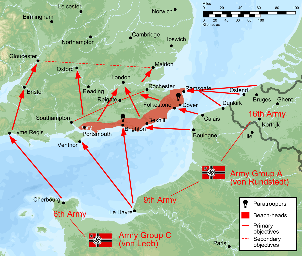
English: Plan of battle of Operation Sealion, the cancelled German plan to invade England in 1940. Vector version of Image:Operazione-leone-marino.PNG, created by Resigua of the Italian Wikipedia.
Ordnance Survey projection, covering from XJ170777 in the south-west to TJ447250 in the north-east, at 100m per pixel. Relief has been created from SRTM, bathymetry from ETOPO1, both from NASA. Coastlines are from the GSHHS, and the borders and rivers from the WDB data bundled with it. |
||
| Source | Own work | ||
| Author | User:Wereon | ||
| Permission (Reusing this file) |
|
||
| Other versions |
[]
|




File history
Click on a date/time to view the file as it appeared at that time.
| Date/Time | Thumbnail | Dimensions | User | Comment | |
|---|---|---|---|---|---|
| current | 19:06, 19 March 2013 | | 5,277 × 4,473 (2.04 MB) | wikimediacommons>Hel-hama | text quality improved |
File usage
The following 6 pages use this file:
