File:Matabeleland.png
Jump to navigation
Jump to search
No higher resolution available.
Matabeleland.png (582 × 599 pixels, file size: 285 KB, MIME type: image/png)
| Description |
|
||
| Date | |||
| Source | Modified version of Image:Matabeleland.gif. | ||
| Author | Scanned by Ulamm (talk · contribs), modified by Fvasconcellos (talk · contribs) | ||
| Permission (Reusing this file) |
   This file is licensed under the Creative Commons Attribution-Share Alike 2.0 Generic license.
|


File history
Click on a date/time to view the file as it appeared at that time.
| Date/Time | Thumbnail | Dimensions | User | Comment | |
|---|---|---|---|---|---|
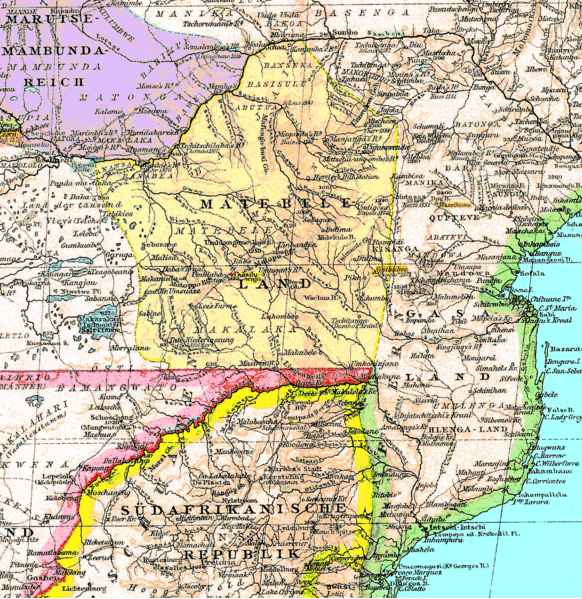
| current | 19:26, 9 March 2008 | No thumbnail | 582 × 599 (285 KB) | wikimediacommons>Fvasconcellos | {{Information |Description = {{en|An 1887 map of southern Africa showing {{w|Matabeleland}} (part of present-day {{w|Zimbabwe}}).}} {{RetouchedPicture|Extraneous German-language labels removed, converted to PNG format|editor=Fvasconcellos|orig=Matabelelan |
