
File:Map of traditionnal provinces of Libye fr.svg
Jump to navigation
Jump to search
Size of this PNG preview of this SVG file: 625 × 599 pixels. Other resolutions: 250 × 240 pixels | 501 × 480 pixels | 801 × 768 pixels | 1,068 × 1,024 pixels | 2,136 × 2,048 pixels | 969 × 929 pixels.


Original file (SVG file, nominally 969 × 929 pixels, file size: 117 KB)

| Description |
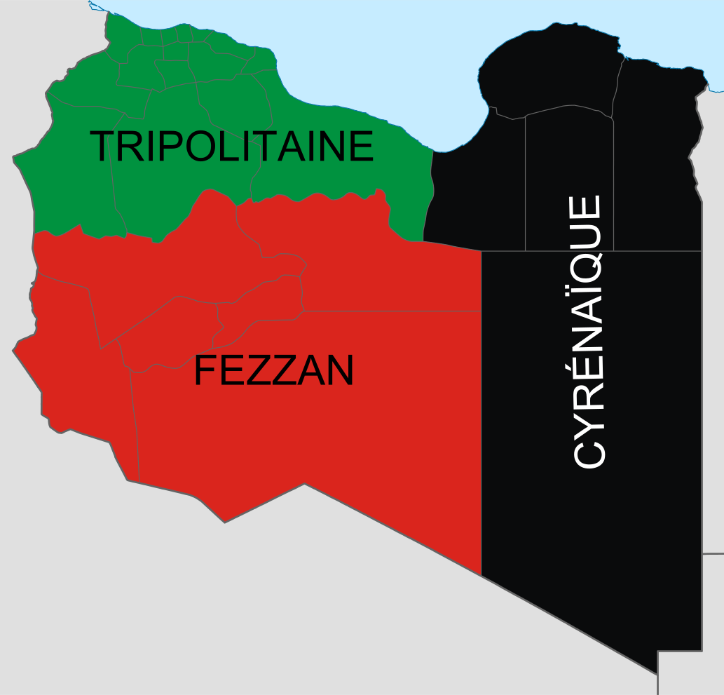
Deutsch: Historische provinzen (Governorates) Libyens
English: Map of the three Governorates of Libya. After independence in 1951, until 1963, Libya was divided into three governorates (muhafazat): Cyrenaica, Tripolitania, and Fezzan.
Español: Mapa de las tres governorates de Libia: Tripolitania, Fezzan, y Cirenaica.
Français : Carte de les trois governorates de Libya. |
| Date | (UTC) |
| Source | |
| Author |
|
| Other versions |
Derivative works of this file: |


 |
This is a retouched picture, which means that it has been digitally altered from its original version. The original can be viewed here: Libya location map.svg:  . .
|

|
This SVG file contains embedded text that can be translated into your language, using any capable SVG editor, text editor or the SVG Translate tool. For more information see: About translating SVG files. |

I, the copyright holder of this work, hereby publish it under the following licenses:


This file is licensed under the Creative Commons Attribution 3.0 Unported license.
- You are free:
- to share – to copy, distribute and transmit the work
- to remix – to adapt the work
- Under the following conditions:
- attribution – You must give appropriate credit, provide a link to the license, and indicate if changes were made. You may do so in any reasonable manner, but not in any way that suggests the licensor endorses you or your use.

|
Permission is granted to copy, distribute and/or modify this document under the terms of the GNU Free Documentation License, Version 1.2 or any later version published by the Free Software Foundation; with no Invariant Sections, no Front-Cover Texts, and no Back-Cover Texts. A copy of the license is included in the section entitled GNU Free Documentation License. |
You may select the license of your choice.
Original upload log
This image is a derivative work of the following images:
- File:Libya_location_map.svg licensed with Cc-by-3.0, GFDL
- 2009-05-18T19:15:09Z NordNordWest 970x931 (153997 Bytes) finalized
- 2009-05-18T16:19:40Z NordNordWest 969x930 (130529 Bytes) {{Information |Description= {{de|Positionskarte von [[:de:Libyen|Libyen]], Vorversion}} Quadratische Plattkarte, N-S-Streckung 110 %. Geographische Begrenzung der Karte: * N: 33.4° N * S: 19.1° N * W: 9.1° O * O: 25.5° O
Uploaded with derivativeFX
File history
Click on a date/time to view the file as it appeared at that time.
| Date/Time | Thumbnail | Dimensions | User | Comment | |
|---|---|---|---|---|---|
| current | 14:34, 25 February 2011 | | 969 × 929 (117 KB) | wikimediacommons>Пакко | upg |
File usage
The following page uses this file:
