File:Map of Oregon highlighting Multnomah County.svg
Jump to navigation
Jump to search

Size of this PNG preview of this SVG file: 800 × 597 pixels. Other resolutions: 320 × 239 pixels | 640 × 477 pixels | 1,024 × 764 pixels | 1,280 × 955 pixels | 2,560 × 1,910 pixels | 1,433 × 1,069 pixels.
Original file (SVG file, nominally 1,433 × 1,069 pixels, file size: 104 KB)
Summary
| Description |
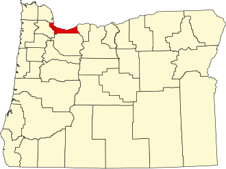
English: This is a locator map showing Multnomah County in Oregon. For more information, see Commons:United States county locator maps. |
| Date | |
| Source |
Own work: English: The maps use data from nationalatlas.gov, specifically countyp020.tar.gz on the Raw Data Download page. The maps also use state outline data from statesp020.tar.gz. The Florida maps use hydrogm020.tar.gz to display Lake Okeechobee. |
| Author | David Benbennick |
| SVG development |

Licensing
| I, the copyright holder of this work, release this work into the public domain. This applies worldwide. In some countries this may not be legally possible; if so: I grant anyone the right to use this work for any purpose, without any conditions, unless such conditions are required by law. |
File history
Click on a date/time to view the file as it appeared at that time.
| Date/Time | Thumbnail | Dimensions | User | Comment | |
|---|---|---|---|---|---|
| current | 22:27, 24 June 2024 | | 1,433 × 1,069 (104 KB) | wikimediacommons>Nux | fix rendering (remove clipping) |
File usage
The following 36 pages use this file:
- 2006 Portland, Oregon area elections
- Bonneville, Oregon
- Bridal Veil, Oregon
- Burlington, Multnomah County, Oregon
- Cedar Mill, Oregon
- Corbett, Oregon
- Dodson, Oregon
- Dunthorpe, Oregon
- East County (Oregon)
- Faces of Meth
- Fairview, Oregon
- Gresham, Oregon
- Holbrook, Oregon
- Interlachen, Oregon
- Lake Oswego, Oregon
- Latourell, Oregon
- List of counties in Oregon
- Maywood Park, Oregon
- Milwaukie, Oregon
- Multnomah County, Oregon
- National Register of Historic Places listings in Multnomah County, Oregon
- Orient, Oregon
- Portland, Oregon
- Riverview, Multnomah County, Oregon
- Riverwood, Oregon
- Springdale, Oregon
- Troutdale, Oregon
- Warrendale, Oregon
- West Haven-Sylvan, Oregon
- Wood Village, Oregon
- User:AridCeption/sandbox
- User:Nyttend/County templates/OR
- MyWiki talk:WikiProject Geography/Archive 3
- File talk:Map of Oregon highlighting Multnomah County.svg
- Template:Multnomah County, Oregon
- Category:Populated places in Multnomah County, Oregon