File:Map of Indiana highlighting Martin County.svg
Jump to navigation
Jump to search

Size of this PNG preview of this SVG file: 391 × 599 pixels. Other resolutions: 156 × 240 pixels | 313 × 480 pixels | 501 × 768 pixels | 668 × 1,024 pixels | 1,337 × 2,048 pixels | 722 × 1,106 pixels.
Original file (SVG file, nominally 722 × 1,106 pixels, file size: 42 KB)
Summary
| Description |
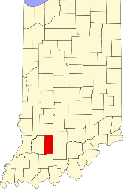
English: This is a locator map showing Martin County in Indiana. For more information, see Commons:United States county locator maps. |
| Date | |
| Source |
Own work: English: The maps use data from nationalatlas.gov, specifically countyp020.tar.gz on the Raw Data Download page. The maps also use state outline data from statesp020.tar.gz. The Florida maps use hydrogm020.tar.gz to display Lake Okeechobee. |
| Author | David Benbennick |
Licensing
| I, the copyright holder of this work, release this work into the public domain. This applies worldwide. In some countries this may not be legally possible; if so: I grant anyone the right to use this work for any purpose, without any conditions, unless such conditions are required by law. |
File history
Click on a date/time to view the file as it appeared at that time.
| Date/Time | Thumbnail | Dimensions | User | Comment | |
|---|---|---|---|---|---|
| current | 14:42, 25 June 2024 | | 722 × 1,106 (42 KB) | wikimediacommons>Nux | uniform colors with good contrast |
File usage
The following 36 pages use this file:
- Bramble, Indiana
- Burns City, Indiana
- Cale, Indiana
- Center Township, Martin County, Indiana
- Crane, Indiana
- Dover Hill, Indiana
- Halbert Township, Martin County, Indiana
- Hindostan Falls, Indiana
- Indian Springs, Indiana
- Ironton, Indiana
- Lacy, Indiana
- List of Indiana state historical markers in Martin County
- List of counties in Indiana
- Loogootee, Indiana
- Lost River Township, Martin County, Indiana
- Martin County, Indiana
- Martin County Courthouse (Indiana)
- Martin State Forest
- Mitcheltree Township, Martin County, Indiana
- Mount Olive, Indiana
- Mount Pleasant, Martin County, Indiana
- Natchez, Indiana
- National Register of Historic Places listings in Martin County, Indiana
- Padanaram Settlement
- Perry Township, Martin County, Indiana
- Pleasant Valley, Martin County, Indiana
- Rusk, Indiana
- Rutherford Township, Martin County, Indiana
- Shoals, Indiana
- Trinity Springs, Indiana
- Whitfield, Indiana
- User:Br.gamache/sandbox
- User:Nyttend/County templates/IN/2
- Template:MartinCountyIN-geo-stub
- Template:Martin County, Indiana
- Category:Populated places in Martin County, Indiana