File:Map of Georgia highlighting Chatham County.svg
Jump to navigation
Jump to search

Size of this PNG preview of this SVG file: 518 × 600 pixels. Other resolutions: 207 × 240 pixels | 414 × 480 pixels | 663 × 768 pixels | 884 × 1,024 pixels | 1,768 × 2,048 pixels | 740 × 857 pixels.
Original file (SVG file, nominally 740 × 857 pixels, file size: 398 KB)
Summary
| Description |
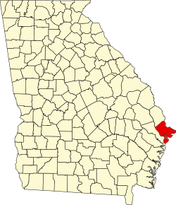
English: This is a locator map showing Chatham County in Georgia. For more information, see Commons:United States county locator maps. |
| Date | |
| Source |
Own work: English: The maps use data from nationalatlas.gov, specifically countyp020.tar.gz on the Raw Data Download page. The maps also use state outline data from statesp020.tar.gz. The Florida maps use hydrogm020.tar.gz to display Lake Okeechobee. |
| Author | David Benbennick |
Licensing
| I, the copyright holder of this work, release this work into the public domain. This applies worldwide. In some countries this may not be legally possible; if so: I grant anyone the right to use this work for any purpose, without any conditions, unless such conditions are required by law. |
File history
Click on a date/time to view the file as it appeared at that time.
| Date/Time | Thumbnail | Dimensions | User | Comment | |
|---|---|---|---|---|---|
| current | 13:31, 25 June 2024 | No thumbnail | 740 × 857 (398 KB) | wikimediacommons>Nux | uniform colors with good contrast |
File usage
The following 32 pages use this file:
- Beaulieu, Georgia
- Bethesda, Chatham County, Georgia
- Bloomingdale, Georgia
- Chatham County, Georgia
- Dutch Island, Georgia
- Garden City, Georgia
- Georgetown, Chatham County, Georgia
- Henderson, Georgia
- Isle of Hope, Georgia
- List of census-designated places in Georgia
- List of counties in Georgia
- Montgomery, Georgia
- National Register of Historic Places listings in Chatham County, Georgia
- Pin Point, Georgia
- Pooler, Georgia
- Port Wentworth, Georgia
- Sandfly, Georgia
- Savannah, Georgia
- Silk Hope, Georgia
- Skidaway Island, Georgia
- Talahi Island, Georgia
- Thunderbolt, Georgia
- Tybee Island, Georgia
- Vernonburg, Georgia
- White Bluff, Georgia
- Whitemarsh Island, Georgia
- Wilmington Island, Georgia
- User:Nyttend/County templates/GA/1
- File talk:Map of Georgia highlighting Chatham County.svg
- Template:Chatham County, Georgia
- Category:Populated places in Chatham County, Georgia
- Category:Wikipedia requested photographs in Chatham County, Georgia