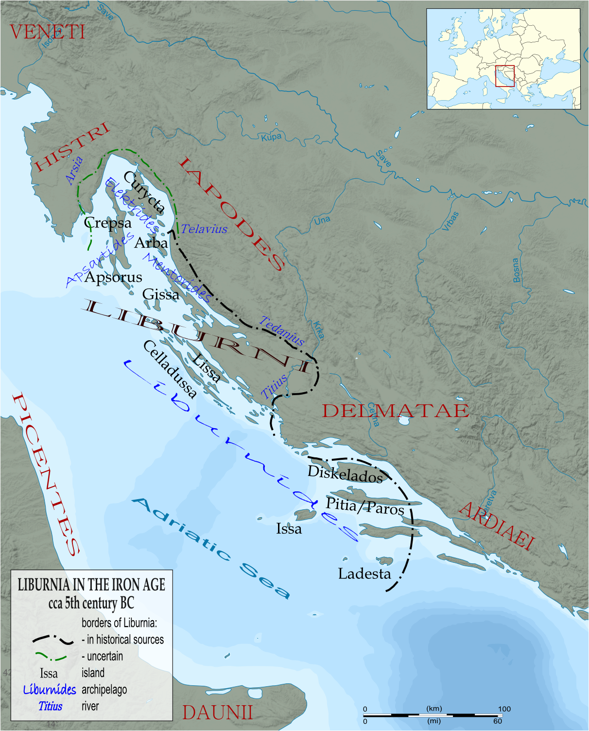
File:Liburnia 5th BC.PNG
Jump to navigation
Jump to search
Original file (1,212 × 1,504 pixels, file size: 1.16 MB, MIME type: image/png)
| Description | Liburnia and central Adriatic archipelago under Liburnian rule in the 5th century BC. | ||
| Date | 18.12.2009 - original | ||
| Source | Based on multiple sources, the main used for this map: M. Zaninović, Liburnia Militaris, Opusc. Archeol. 13, 43-67 (1988), UDK 904.930.2(497.13)>>65<<, M. Blečić, Prilog poznavanju antičke Tarsatike, VAMZ, 3.s., XXXIV 65-122 (2001), UDK 904:72.032 (3:497.5). Base map: Dinaric Alps National Parks map-fr.svg. | ||
| Author | Zenanarh | ||
| Permission (Reusing this file) |
|
||
| Other versions | Derivative works of this file: Liburnia 5th BC-SL.PNG |




File history
Click on a date/time to view the file as it appeared at that time.
| Date/Time | Thumbnail | Dimensions | User | Comment | |
|---|---|---|---|---|---|
| current | 13:17, 12 June 2010 | No thumbnail | 1,212 × 1,504 (1.16 MB) | wikimediacommons>Bostjan46 | {{Information |Description=Liburnia and central Adriatic archipelago under Liburnian rule in the 5th century BC. |Source= Based on multiple sources, the main used for this map: M. Zaninović, Liburnia Militaris, Opusc. Archeol. 13, 43-67 (1988), UDK 904. |
File usage
The following page uses this file:
