File:Kuwait-Iraq barrier.png
Jump to navigation
Jump to search

Size of this preview: 522 × 600 pixels. Other resolutions: 209 × 240 pixels | 418 × 480 pixels | 668 × 768 pixels | 1,060 × 1,218 pixels.
Original file (1,060 × 1,218 pixels, file size: 964 KB, MIME type: image/png)
Transwiki approved by: w:en:User:Dmcdevit
This image was copied from wikipedia:en. The original description was:


Original map license (map from the CIA):

|
This image is a work of a Central Intelligence Agency employee, taken or made as part of that person's official duties. As a Work of the United States Government, this image or media is in the public domain in the United States.
|

|
Source: Courtesy of the University of Texas Libraries, The University of Texas at Austin for the map originally found at : http://www.lib.utexas.edu/maps/middle_east_and_asia/kuwait_pol96.jpg
Modified map license (the one that can be seen here)
|
|
I, the copyright holder of this work, release this work into the public domain. This applies worldwide. In some countries this may not be legally possible; if so: I grant anyone the right to use this work for any purpose, without any conditions, unless such conditions are required by law. |
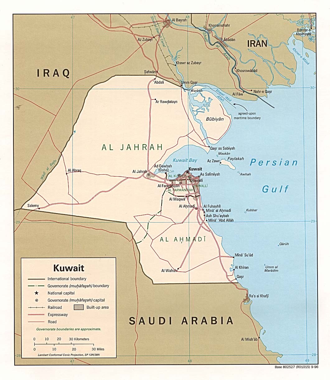
I drew the barrier on the map, based on the fact it extends 6 miles into Iraq and 3 into Kuwait.
Note
Even though this is a .png file the original file is .jpg, so the quality is fairly low.
.xcf version, can be opened in w:en:GIMP
Original upload log
| date/time | username | resolution | size | edit summary |
|---|---|---|---|---|
| 16:27, 21 June 2007 | w:en:User:Jackaranga | 1060×1218 | 1.38 MB | {{BadJPG}} ==Original map license (map from the CIA):== {{PD-USgov}} Source: ''Courtesy of the University of Texas Libraries, The University of Texas at Austin'' for the map originally found at : http://www.lib.utexas.edu/maps/middle_east_and_asia/kuwait |
Image description page history
| link | date/time | username | edit summary |
|---|---|---|---|
| http://en.wikipedia.org/w/index.php?title=Image:Kuwait-Iraq_barrier.png&redirect=no&oldid=139701165 | 08:50, 7 September 2007 | w:en:User:Dmcdevit | |
| http://en.wikipedia.org/w/index.php?title=Image:Kuwait-Iraq_barrier.png&redirect=no&oldid=139701165 | 16:52, 21 June 2007 | w:en:User:Jackaranga | |
| http://en.wikipedia.org/w/index.php?title=Image:Kuwait-Iraq_barrier.png&redirect=no&oldid=139696697 | 16:31, 21 June 2007 | w:en:User:Jackaranga | |
| http://en.wikipedia.org/w/index.php?title=Image:Kuwait-Iraq_barrier.png&redirect=no&oldid=139695842 | 16:27, 21 June 2007 | w:en:User:Jackaranga | ({{BadJPG}} ==Original map license (map from the CIA):== {{PD-USgov}} Source: ''Courtesy of the University of Texas Libraries, The University of Texas at Austin'' for the map originally found at : http://www.lib.utexas.edu/maps/middle_east_and_asia/kuwait) |


File history
Click on a date/time to view the file as it appeared at that time.
| Date/Time | Thumbnail | Dimensions | User | Comment | |
|---|---|---|---|---|---|
| current | 22:42, 7 April 2021 | | 1,060 × 1,218 (964 KB) | wikimediacommons>JohnVanVliet | jpg artifact removal |
File usage
The following 3 pages use this file:
