
File:InZicht Appingedam 006.JPG
Jump to navigation
Jump to search
Size of this preview: 800 × 468 pixels. Other resolutions: 320 × 187 pixels | 640 × 374 pixels | 1,024 × 599 pixels | 1,280 × 749 pixels | 2,560 × 1,498 pixels | 3,555 × 2,080 pixels.


Original file (3,555 × 2,080 pixels, file size: 983 KB, MIME type: image/jpeg)

Summary
| Description |
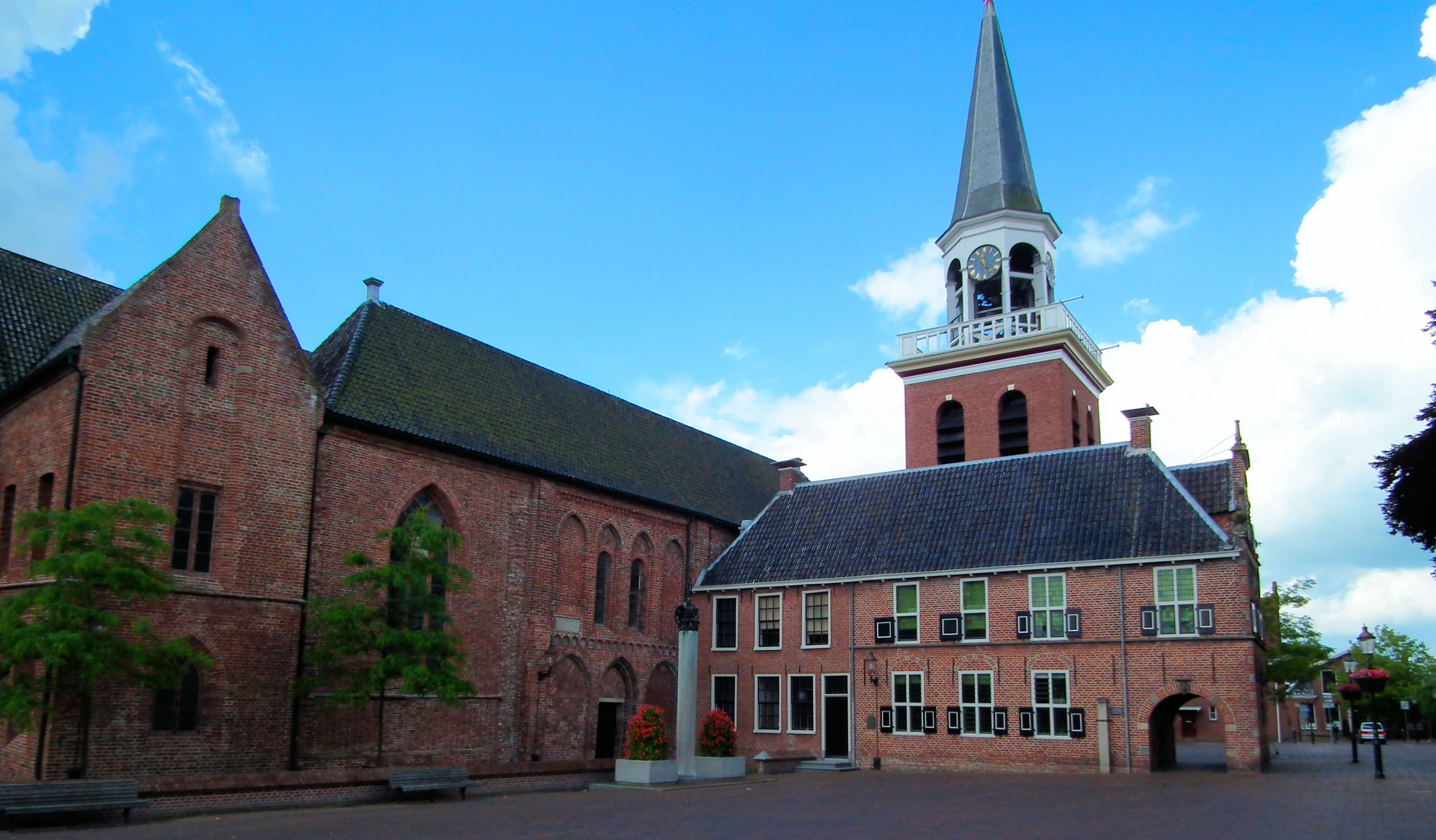
Nederlands: Het historische centrum van Appingedam (NL) - Stadhuis en Nicolaikerk |
| Date | |
| Source | Own work |
| Author | Microtoerisme |
| Camera location |  | View this and other nearby images on: OpenStreetMap |  |
|---|

Deze afbeelding wordt u aangeboden door de Stichting Microtoerisme Inzicht.
Licensing


This file is licensed under the Creative Commons Attribution-Share Alike 3.0 Unported license.
Attribution:
- You are free:
- to share – to copy, distribute and transmit the work
- to remix – to adapt the work
- Under the following conditions:
- attribution – You must give appropriate credit, provide a link to the license, and indicate if changes were made. You may do so in any reasonable manner, but not in any way that suggests the licensor endorses you or your use.
- share alike – If you remix, transform, or build upon the material, you must distribute your contributions under the same or compatible license as the original.

|
Attribution information, such as the author's name, e-mail, website, or signature, that was once visible in the image itself has been moved into the image metadata and/or image description page. This makes the image easier to reuse and more language-neutral, and makes the text easier to process and search for. Commons discourages placing visible author information in images.
|
File history
Click on a date/time to view the file as it appeared at that time.
| Date/Time | Thumbnail | Dimensions | User | Comment | |
|---|---|---|---|---|---|
| current | 06:58, 12 July 2013 | | 3,555 × 2,080 (983 KB) | wikimediacommons>Rybecbot | cropped to remove watermark |
File usage
The following 2 pages use this file:
