File:GG2.PNG
Jump to navigation
Jump to search
Size of this preview: 800 × 377 pixels. Other resolutions: 320 × 151 pixels | 640 × 302 pixels | 1,300 × 613 pixels.
Original file (1,300 × 613 pixels, file size: 2.14 MB, MIME type: image/png)
Summary
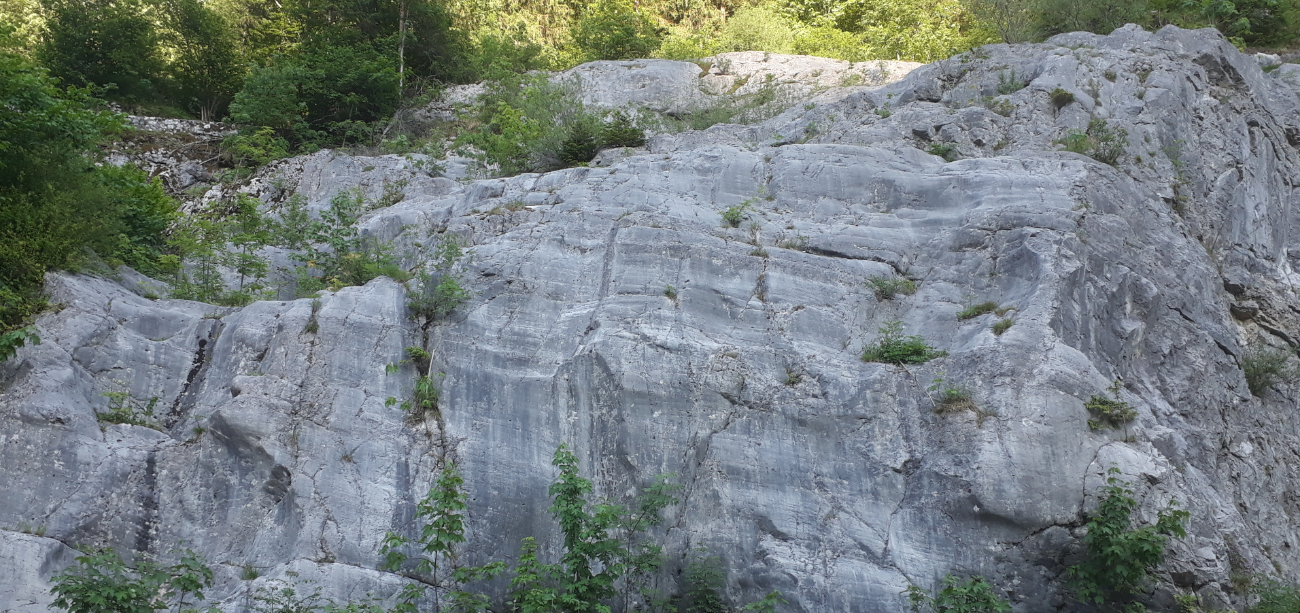
| Description | The Gletschergarten Weißbach is a German glacial geotope situated in the Chiemgau Alps in Upper Bavaria. It belongs to the commune of Schneizlreuth and shows glacial striations and moulins. It was formed by the Saalach Glacier at the end of the last glaciation about 12.000 years ago. |
| Date | |
| Source | Own work |
| Author | Rudolf Pohl |
Licensing
I, the copyright holder of this work, hereby publish it under the following licenses:
This file is licensed under the Creative Commons Attribution-Share Alike 4.0 International license.
- You are free:
- to share – to copy, distribute and transmit the work
- to remix – to adapt the work
- Under the following conditions:
- attribution – You must give appropriate credit, provide a link to the license, and indicate if changes were made. You may do so in any reasonable manner, but not in any way that suggests the licensor endorses you or your use.
- share alike – If you remix, transform, or build upon the material, you must distribute your contributions under the same or compatible license as the original.

|
Permission is granted to copy, distribute and/or modify this document under the terms of the GNU Free Documentation License, Version 1.2 or any later version published by the Free Software Foundation; with no Invariant Sections, no Front-Cover Texts, and no Back-Cover Texts. A copy of the license is included in the section entitled GNU Free Documentation License. |
You may select the license of your choice.
File history
Click on a date/time to view the file as it appeared at that time.
| Date/Time | Thumbnail | Dimensions | User | Comment | |
|---|---|---|---|---|---|
| current | 12:02, 21 June 2021 | | 1,300 × 613 (2.14 MB) | wikimediacommons>Rudolf Pohl | {{Information |Description=The ''Gletschergarten Weißbach'' is a German glacial geotope situated in the Chiemgau Alps in Upper Bavaria. It belongs to the commune of Schneizlreuth and shows glacial striations and moulins. It was formed by the Saalach Glacier at the end of the last glaciation about 12.000 years ago. |Source={{own}} |Date=21/06/2021 |Author= Rudolf Pohl |Permission= |other_versions= }} Category:Chiemgau Alps Category:Geomorphology [[Category:Glacial... |
File usage
The following page uses this file: