File:Egypt 1450 BC.svg
Jump to navigation
Jump to search
Size of this PNG preview of this SVG file: 520 × 600 pixels. Other resolutions: 208 × 240 pixels | 416 × 480 pixels | 666 × 768 pixels | 887 × 1,024 pixels | 1,775 × 2,048 pixels | 1,300 × 1,500 pixels.
Original file (SVG file, nominally 1,300 × 1,500 pixels, file size: 257 KB)

Summary
| Description |
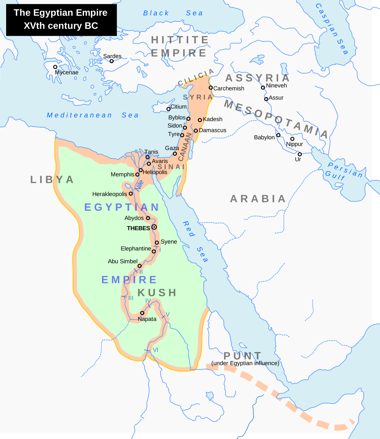
English: Map of the Middle East 1450 BC (by ArdadN)
Čeština: Největší územní rozsah starověkého Egypta, za vlády Thutmose I. |
| Source |
The original description page was here. All following user names refer to en.wikipedia.
|
| Author | ArdadN at English Wikipedia |
| Other versions |
[]
|


|
This SVG file contains embedded text that can be translated into your language, using any capable SVG editor, text editor or the SVG Translate tool. For more information see: About translating SVG files. |

Licensing

|
I, the copyright holder of this work, release this work into the public domain. This applies worldwide. In some countries this may not be legally possible; if so: I grant anyone the right to use this work for any purpose, without any conditions, unless such conditions are required by law. |
File history
Click on a date/time to view the file as it appeared at that time.
| Date/Time | Thumbnail | Dimensions | User | Comment | |
|---|---|---|---|---|---|
| current | 18:29, 14 May 2026 | | 1,300 × 1,500 (257 KB) | wikimediacommons>Socialwave597 | Reverted to version as of 09:50, 14 July 2025 (UTC) Punt definitely corresponds to modern Eritrea. |
File usage
The following 14 pages use this file:
- Land of Punt
- List of conflicts in Libya
- List of conflicts in Sudan
- Middle Eastern empires
- The Bible Unearthed
- Timeline of Jerusalem
- Transjordan (region)
- Talk:The Exodus/Archive 18
- User:Falcaorib/Ancient Empires (4000-550 BC)
- User:Falcaorib/Egypt
- User:Falcaorib/Iraq and Mesopotamia
- User:Falcaorib/Israel and Palestine
- User:Falcaorib/Syria and Lebanon
- User:SomeGuyWhoRandomlyEdits/List of conflicts in the Near East
