
File:CIS mapwithnumbers.png
Jump to navigation
Jump to search
Size of this preview: 800 × 547 pixels. Other resolutions: 320 × 219 pixels | 640 × 438 pixels | 1,024 × 701 pixels | 1,356 × 928 pixels.


Original file (1,356 × 928 pixels, file size: 62 KB, MIME type: image/png)

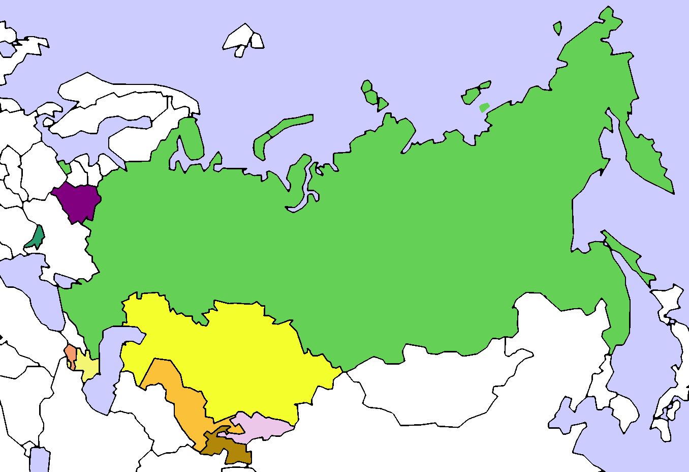
| Description | Map of the Commonwealth of Independent States (CIS). Created by User:Aris Katsaris, based on Image:Soviet Union Map.png |
| Date | (UTC) |
| Source | |
| Author |
|

 |
This is a retouched picture, which means that it has been digitally altered from its original version. Modifications: added colours and numbers. The original can be viewed here: CIS Map.png:  . Modifications made by Lies Van Rompaey. . Modifications made by Lies Van Rompaey.
|
I, the copyright holder of this work, hereby publish it under the following license:

|
Permission is granted to copy, distribute and/or modify this document under the terms of the GNU Free Documentation License, Version 1.2 or any later version published by the Free Software Foundation; with no Invariant Sections, no Front-Cover Texts, and no Back-Cover Texts. A copy of the license is included in the section entitled GNU Free Documentation License. |
  
|
This file is licensed under the Creative Commons Attribution-Share Alike 3.0 Unported license. | |
| ||
| This licensing tag was added to this file as part of the GFDL licensing update. |
Original upload log
This image is a derivative work of the following images:
- File:_CIS_Map.png licensed with GFDL, GFDL/en
- 2008-08-14T21:32:15Z Voland77 1356x928 (110892 Bytes) update: according to the CIS treaty countries willing to exit the organization have to announce this intention 12 month before they can actually leave it.
- 2008-08-14T15:56:03Z Voland77 1356x928 (128298 Bytes) update (Georgia withdrawal)
- 2008-08-13T17:07:35Z Переход Артур 1356x928 (52266 Bytes) {{Information |Description=Map of the Commonwealth of Independent States (CIS). |Source= |Date= |Author=Created by [[User:Aris Katsaris]], based on [[:Image:Soviet Union Map.png]] |Permission= |other_versions= }} {{GFDL}} {
- 2008-08-12T21:54:56Z Akhristov 1356x928 (26542 Bytes) "Official Website" isn't working, I don't see how you checked. Let's quit this war. (Added Moldova as Associate Member)
- 2008-08-12T21:42:46Z Переход Артур 1356x928 (23233 Bytes) According to the official website of the organiazation Ukraine is a member of CIS
- 2008-08-12T21:35:52Z Akhristov 1356x928 (26564 Bytes) Reverted to version as of 21:34, 12 August 2008
- 2008-08-12T21:34:56Z Переход Артур 1356x928 (23233 Bytes) Ukraine is still a member of CIS
- 2008-08-12T21:34:41Z Akhristov 1356x928 (26564 Bytes) Ukraine is an Associate Member
- 2008-08-12T20:52:15Z Akhristov 1356x928 (26495 Bytes) {{Information |Description= |Source= |Date= |Author= |Permission= |other_versions= }}
- 2008-08-12T18:15:45Z Óðinn 1356x928 (23233 Bytes) Reverted to version as of 05:54, 3 July 2007 The formal process is yet to take place
- 2008-08-12T12:38:52Z Anthony040 1356x928 (62635 Bytes) {{Information |Description=The CIS following Georgia's decision to leave on August 12, 2008. |Source= |Date=August 12, 2008 |Author=Anthony040 |Permission= |other_versions= }}
- 2007-07-03T05:54:40Z PatrikR 1356x928 (23233 Bytes) losslessly optimized with [[:en:OptiPNG]]
- 2006-03-31T17:38:39Z Aris Katsaris 1356x928 (62664 Bytes) tweak in colors (purple full members, orangeish is associate member)
- 2005-04-13T21:25:41Z Aris Katsaris 1356x928 (37707 Bytes) Map of the Commonwealth of Independent States (CIS). Created by [[User:Aris Katsaris]], based on [[:Image:Soviet Union Map.png]] {{GFDL}}
Uploaded with derivativeFX
File history
Click on a date/time to view the file as it appeared at that time.
| Date/Time | Thumbnail | Dimensions | User | Comment | |
|---|---|---|---|---|---|
| current | 21:15, 19 March 2014 | No thumbnail | 1,356 × 928 (62 KB) | wikimediacommons>A2D2 | Update |
File usage
The following page uses this file:
