File:BL postcode area map.svg
Jump to navigation
Jump to search

Size of this PNG preview of this SVG file: 750 × 600 pixels. Other resolutions: 300 × 240 pixels | 600 × 480 pixels | 960 × 768 pixels | 1,280 × 1,024 pixels | 2,560 × 2,048 pixels | 1,000 × 800 pixels.
Original file (SVG file, nominally 1,000 × 800 pixels, file size: 238 KB)
Summary
| Description |
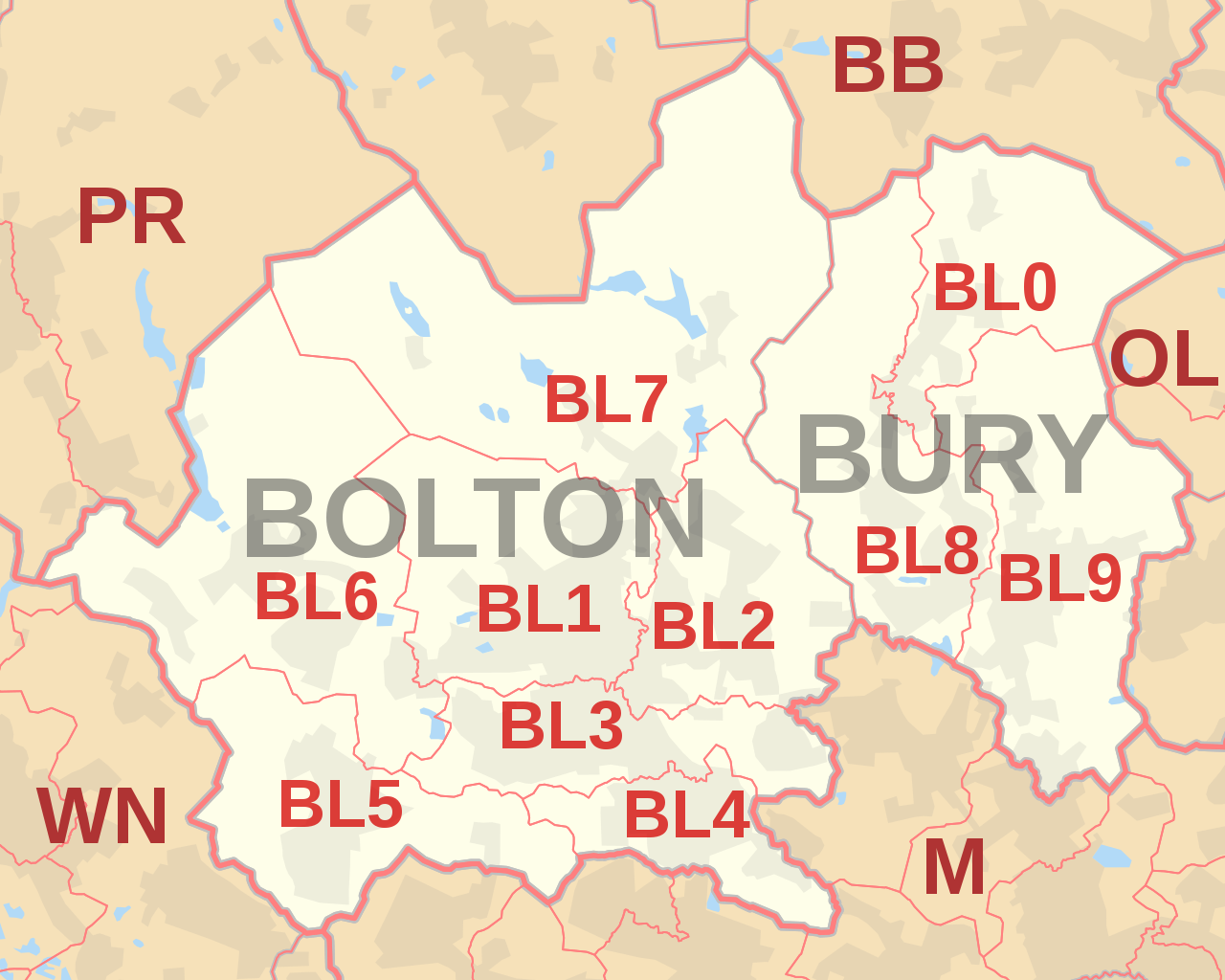
English: Labelled map of Royal Mail postcode districts of the BL postcode area.
Indicative postcode districts shown in red, post towns shown in grey. Equirectangular projection with latitude stretching 170%, WGS84 datum. Geographic limits:
|
| Date | |
| Source |
Own work based on:
|
| Author | Richardguk |
| SVG development |
| Camera location | | View this and other nearby images on: OpenStreetMap |
|---|
Licensing
Richardguk, the copyright holder of this work, hereby publishes it under the following license:
This file is licensed under the Creative Commons Attribution-Share Alike 3.0 Unported license.
Attribution:
- You are free:
- to share – to copy, distribute and transmit the work
- to remix – to adapt the work
- Under the following conditions:
- attribution – You must give appropriate credit, provide a link to the license, and indicate if changes were made. You may do so in any reasonable manner, but not in any way that suggests the licensor endorses you or your use.
- share alike – If you remix, transform, or build upon the material, you must distribute your contributions under the same or compatible license as the original.
This file is licensed by the Ordnance Survey of the United Kingdom under their OS OpenData License
In short: you are free to distribute and modify the file as long as you attribute (including year), the Ordnance Survey and Royal Mail. Attribution: Contains Ordnance Survey and Royal Mail data © Crown copyright and database right (year) Note: Derivative works can be licensed under any Creative Commons Attribution 3.0 Licence. |
.svg)
|
This file is licensed under the United Kingdom Open Government Licence v3.0. |
See also: Meta for information on usage on Wikimedia wikis.
|
File history
Click on a date/time to view the file as it appeared at that time.
| Date/Time | Thumbnail | Dimensions | User | Comment | |
|---|---|---|---|---|---|
| current | 11:22, 16 October 2012 | | 1,000 × 800 (238 KB) | wikimediacommons>Richardguk | revised styling for BL postcode area map |
File usage
The following 3 pages use this file: